In This Guide
The Southern Border to Battle Creek The Agricultural Middle: Nashville to Ionia Into the Center: Six Lakes to Barryton Crossing US-10: Marion, Lake City, and McBain The Northern Finish: Kalkaska to Charlevoix The Ironton Ferry Driving the Whole ThingBest Time to Go
Mid-April – mid-November, roughly 6:30am–10:30pm daily (Ironton Ferry)
The cable ferry that carries M-66 itself across Lake Charlevoix's South Arm only runs in the warmer months — check current hours before planning a crossing outside peak season, since shoulder-season hours can run shorter.
Route 66 never touched Michigan. It ran from Chicago to Santa Monica through eight states, and not one of them was this one — a fact that has never stopped Michiganders from wanting a mother road of their own. As it happens, they have one, and it carries the same number. M-66 begins at the Indiana state line as a continuation of Indiana's State Road 9 and runs more than 260 miles north to Charlevoix, where it ends at US-31 within sight of Lake Michigan. It is the only state highway that runs the full north–south distance of the Lower Peninsula, it is two lanes for most of its length, and when the state extended it south in 1965 the route was promoted under a name that could not be more fitting for a road-trip guide: the Green Arrow Route, a marketing campaign built explicitly around the scenic vacation country the highway threads. What follows is that highway end to end, with more than twenty stops arranged in driving order.
The Southern Border to Battle Creek
The drive begins where Indiana's State Road 9 becomes M-66 at the state line, in the flat agricultural country of St. Joseph County, and the first town of consequence is Sturgis — a place whose nickname, the Electric City, records its early municipal power plant, and whose other claim involves a pan of biscuits and a naming accident. Sturgis also delivers the trip's first great junction: US-12, the Historic US-12 Heritage Trail, which follows the old Sauk Trail across the bottom of the state and is itself among Michigan's finest drives. Travelers with time to spare should note the crossing and file it away for a future trip, because taking it now means abandoning M-66 within the first twenty miles.
North of Sturgis the highway runs through Athens and into Battle Creek, where M-66 does something it does nowhere else along its length: it becomes a freeway. The four-lane expressway south of the city gives way to the I-194 designation for a little over three miles through downtown, a brief stretch of genuine limited-access highway inserted into an otherwise rural two-lane road. Battle Creek itself is worth the stop on cereal-industry history alone — this is the city that Kellogg and Post built, and the civic identity remains bound up in it more than a century later. It is also the last sizable city the highway touches for a long while, which makes it the sensible place to fuel, provision, and commit to the rural middle.
The Agricultural Middle: Nashville to Ionia
North of Battle Creek the freeway ends and the character of the trip settles into what it will be for most of the next two hundred miles: a two-lane road through farm country, small villages, and woodlots, with a stop sign or a blinking light every so often to mark a crossroads community. Nashville and Woodland come in quick succession — genuinely small places, the sort where the business district occupies a single block and the grain elevator is the tallest structure for miles. This is the stretch that rewards a traveler willing to drive slowly and stop for no particular reason, because there is no marquee attraction to organize the day around and the pleasure is entirely in the accumulation of detail.
Ionia arrives as the first real town in a while and brings with it a junction with I-96, the Grand Rapids–Lansing corridor, which means this is the point where a traveler can most easily bail out toward either city. Ionia is best known for its free fair, one of the largest of its kind in the country, and the fairgrounds dominate the town's calendar every summer. For M-66 purposes it is the natural first-night stop on a leisurely two-day run, sitting roughly at the highway's midpoint in terms of both distance and character — the boundary between the settled agricultural south and the increasingly forested north.
Into the Center: Six Lakes to Barryton
North of Ionia the highway climbs into the middle of the mitten, and the landscape begins its gradual handoff from cropland to mixed forest and lake country. Six Lakes, Stanton, and Sheridan follow in sequence — Stanton is the Montcalm County seat and the largest of the three, though largest is a relative term here — and the surrounding country fills with the small inland lakes that give the first of those villages its name. This is cottage country of an unpretentious sort, a long way from the resort economies of Charlevoix and Traverse City, and the lakes are used mostly by people who have been coming to them for generations.
Remus and Barryton continue the pattern northward through Mecosta County. The distances between towns lengthen, the woodlots consolidate into genuine forest, and the traffic thins to the point where a traveler can go several minutes without meeting another vehicle. Services become sparse enough here that fuel planning stops being theoretical — the gap between reliable stations on this stretch is the longest on the route, and a driver who left Battle Creek on a quarter tank intending to sort it out later will find the options limited and the hours irregular.
Crossing US-10: Marion, Lake City, and McBain
The highway crosses US-10 near Sears, marking the transition into northern Michigan proper, and the character shift on the far side is immediate and unmistakable. Marion, Lake City, and McBain follow through Osceola and Missaukee counties, and the country around them is the high, rolling, lake-dotted interior that most travelers associate with the north without ever driving through it — because the interstate-equivalent routes, US-131 and I-75, both bypass this ground entirely on either side. M-66 is one of the only ways to see it at highway speed.
Lake City sits on Lake Missaukee and functions as the recreational center of this stretch, with the water, the small downtown, and the surrounding state forest land supplying the reasons to stop. McBain, a short distance north, is Dutch-settled farm country of a kind more commonly associated with the Holland and Zeeland area two hours southwest. The combination is characteristic of the whole highway: M-66 keeps running into pockets of settlement history that have nothing to do with each other, strung along a single road only because the road happened to be built through them.
The Northern Finish: Kalkaska to Charlevoix
Kalkaska brings the trip's last major junction, where M-66 meets US-131 and M-72 — the crossroads that funnels traffic toward Traverse City to the west and Grayling to the east, and the point at which the highway finally rejoins the tourist mainstream it has spent two hundred miles avoiding. Mancelona follows to the north, and then the road enters the Lake Charlevoix country and the finish becomes genuinely scenic in the conventional sense, with water, hills, and orchard land replacing the forest and farm of the middle sections.
East Jordan sits at the foot of the South Arm of Lake Charlevoix, a town whose iron works have supplied municipal castings — manhole covers among them — to cities across the world from an unlikely base in northern Michigan. From there M-66 runs north to Ironton, where the highway does something almost no highway does: it stops at the water and boards a boat. Charlevoix, four miles further on, is the terminus, where M-66 ends at US-31 in a resort town of drawbridges, mushroom houses, and Lake Michigan harbor traffic — an emphatic contrast with the empty two-lane stretches of Mecosta County that is all the more effective for having been earned across a full day's driving.
The Ironton Ferry
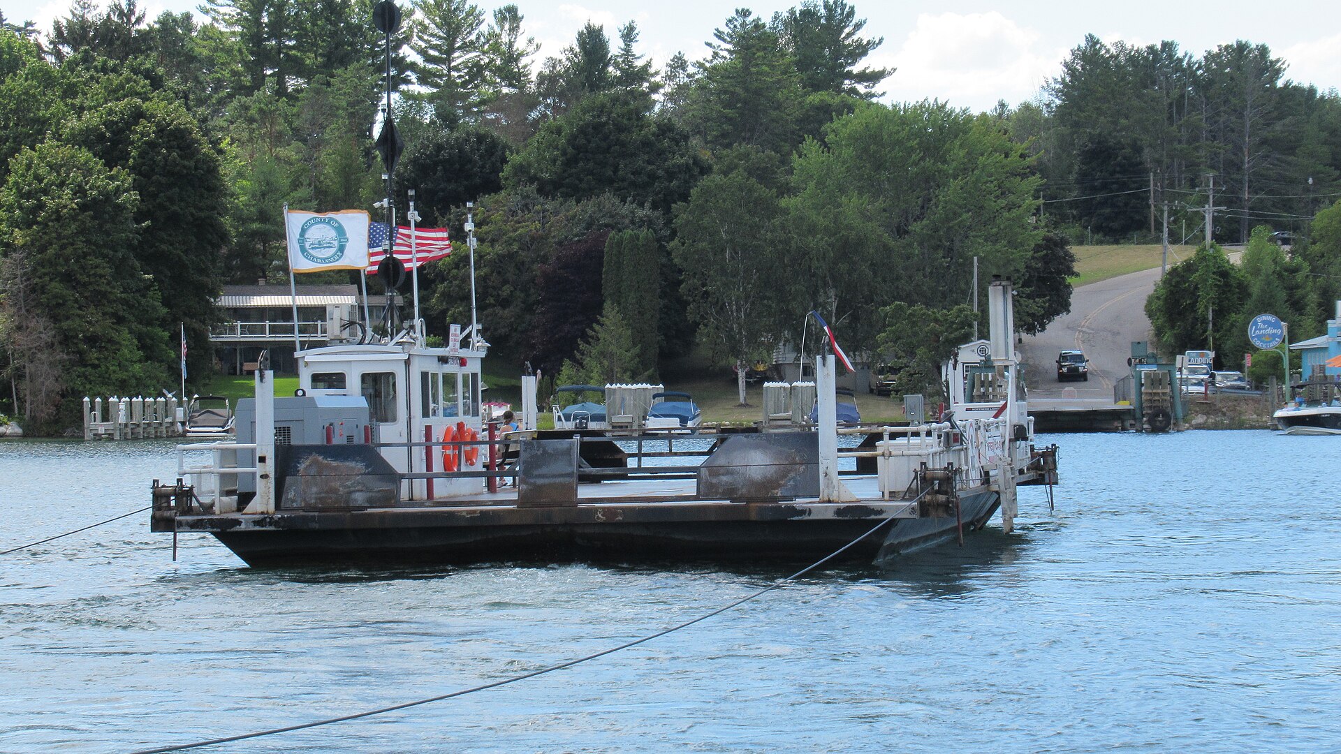
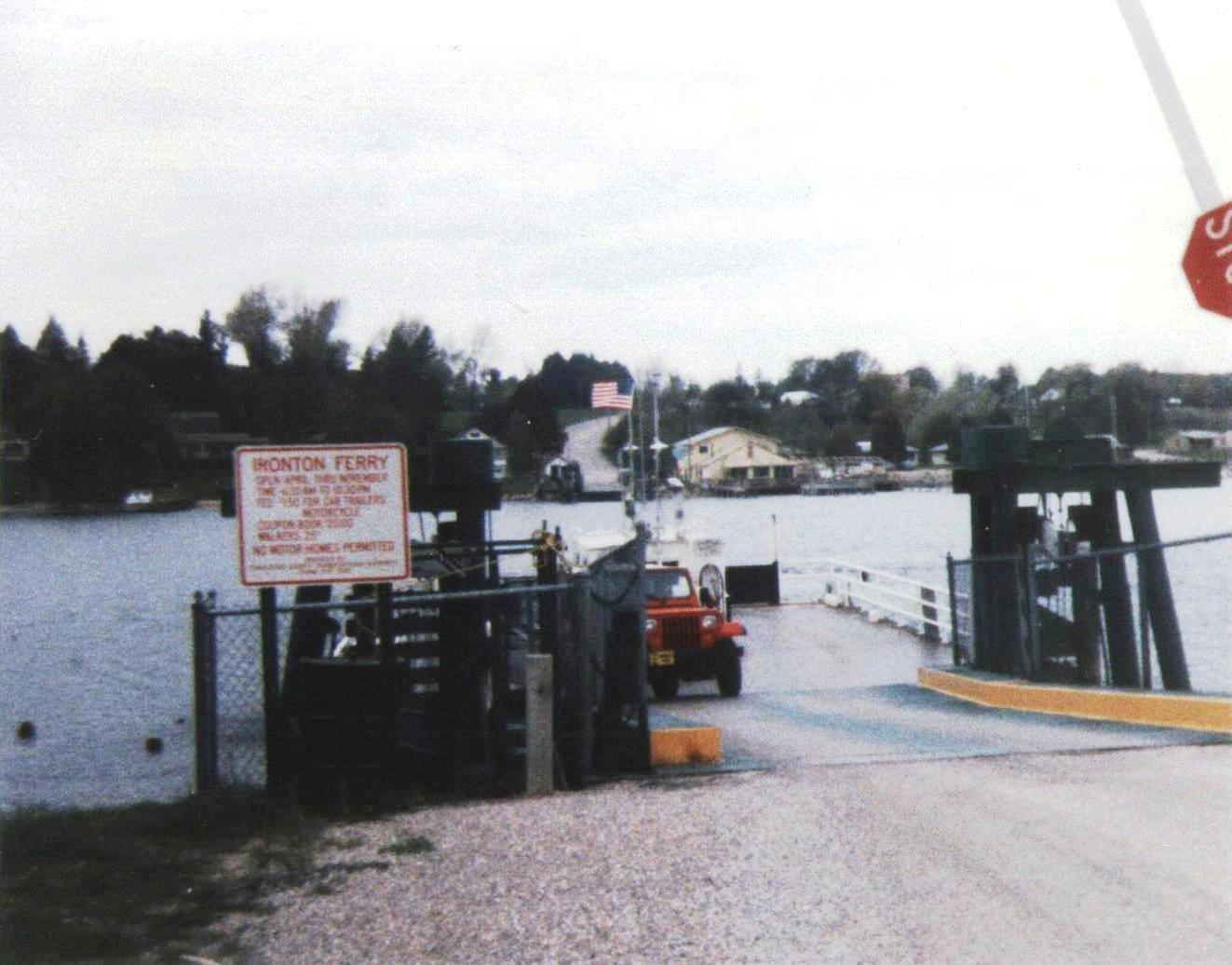
The single best moment on M-66 is a four-car cable ferry that has been crossing the narrows of Lake Charlevoix's South Arm since 1876. The Ironton Ferry carries the highway itself across roughly 610 feet of water in about three minutes, connecting Ironton toward Boyne City, and it is not a tourist attraction that happens to sit near a road — it is the road, a functioning link in the state trunkline system that a driver simply queues for and rides. Skipping it means a substantial detour around the lake.
The engineering is worth appreciating while aboard. The current vessel dates to 1926, is driven by a diesel engine through a hydraulic system with propellers at both ends, and carries no rudder at all; two cables running to either shore do the steering, which is why the ferry can cross without ever turning around. Earlier versions were hauled by hand — with passengers expected to help — and later by horses. Sam Alexander, who operated the crossing from the 1880s into the 1940s, was written up in Ripley's Believe It or Not in 1936 for having traveled an extraordinary cumulative distance while never getting more than a few hundred feet from home. The ferry runs daily from mid-April through mid-November, roughly 6:30 in the morning until 10:30 at night, and travelers planning a late-season run should confirm before counting on it.
Driving the Whole Thing
M-66 can be driven end to end in a long single day, but doing so misses the point badly. The route's pleasures are cumulative and low-key rather than concentrated in a handful of destinations, and the towns that make it worthwhile are exactly the ones a driver blows through when trying to make time. Two days with a night in Ionia or Stanton is the natural shape of the trip; three days allows genuine detours, and the highway crosses enough major junctions — US-12, I-96, US-10, US-131 and M-72 — that side trips are easy to improvise from almost any point.
Practical notes are few but real. Fuel is the main one: the middle third of the route through Montcalm and Mecosta counties has the thinnest services, and topping off at Ionia is cheap insurance. Winter driving is entirely feasible, since this is a maintained state trunkline, but the Ironton Ferry does not run and the northern stretches take lake-effect snow seriously. And the direction matters more than most travelers expect — running south to north saves the water, the hills, and the ferry for the end, and turns the drive into a gradual reveal rather than a long decompression from the scenic part. That, in the end, is the argument for M-66 over any of Michigan's better-marketed scenic byways: it is not a short pretty stretch of road, it is an entire cross-section of a state, and it takes a full day to earn the view at the end.