In This Guide
How the Route Is Assembled The Western End: Porcupine Mountains and the Copper Country The Central Coast: Marquette and Pictured Rocks The Eastern End: Tahquamenon and Whitefish Bay Planning and PracticalitiesLake Superior is the largest freshwater lake in the world by surface area, and a designated route runs all the way around it through Michigan, Wisconsin, Minnesota, and Ontario. Michigan's share is 516 miles, following whichever state trunkline runs closest to the water at any given point — which means the route is not one highway but a stitched sequence of them, threading the Upper Peninsula's entire northern coast from the Wisconsin border at Ironwood to Sault Ste. Marie. It is the wildest of the Great Lakes circle tours and the one that demands the most planning, because the stretches between services are the longest anywhere in Michigan.
How the Route Is Assembled
The Lake Superior Circle Tour in Michigan is defined by proximity to the lake rather than by a single road number, and following it means changing highways repeatedly. From the Wisconsin line it runs US-2 through Ironwood toward Wakefield, picks up M-28 east to Bergland, turns north on M-64 through Silver City to Ontonagon, and continues stitching together trunklines — M-26 through the Keweenaw, M-28 across the central Upper Peninsula, M-77 and M-123 in the east — as the shoreline dictates.
That structure has a practical consequence worth internalizing before departure: there is no single road to simply stay on. Junctions matter, and a driver who stops paying attention will end up on a perfectly good highway heading somewhere other than the lake. As with the other Great Lakes circle tours, signage is inconsistent, so the route should be built in a mapping application in advance and saved offline — particularly across the western Upper Peninsula, where cell coverage is genuinely unreliable rather than merely spotty.
The Western End: Porcupine Mountains and the Copper Country
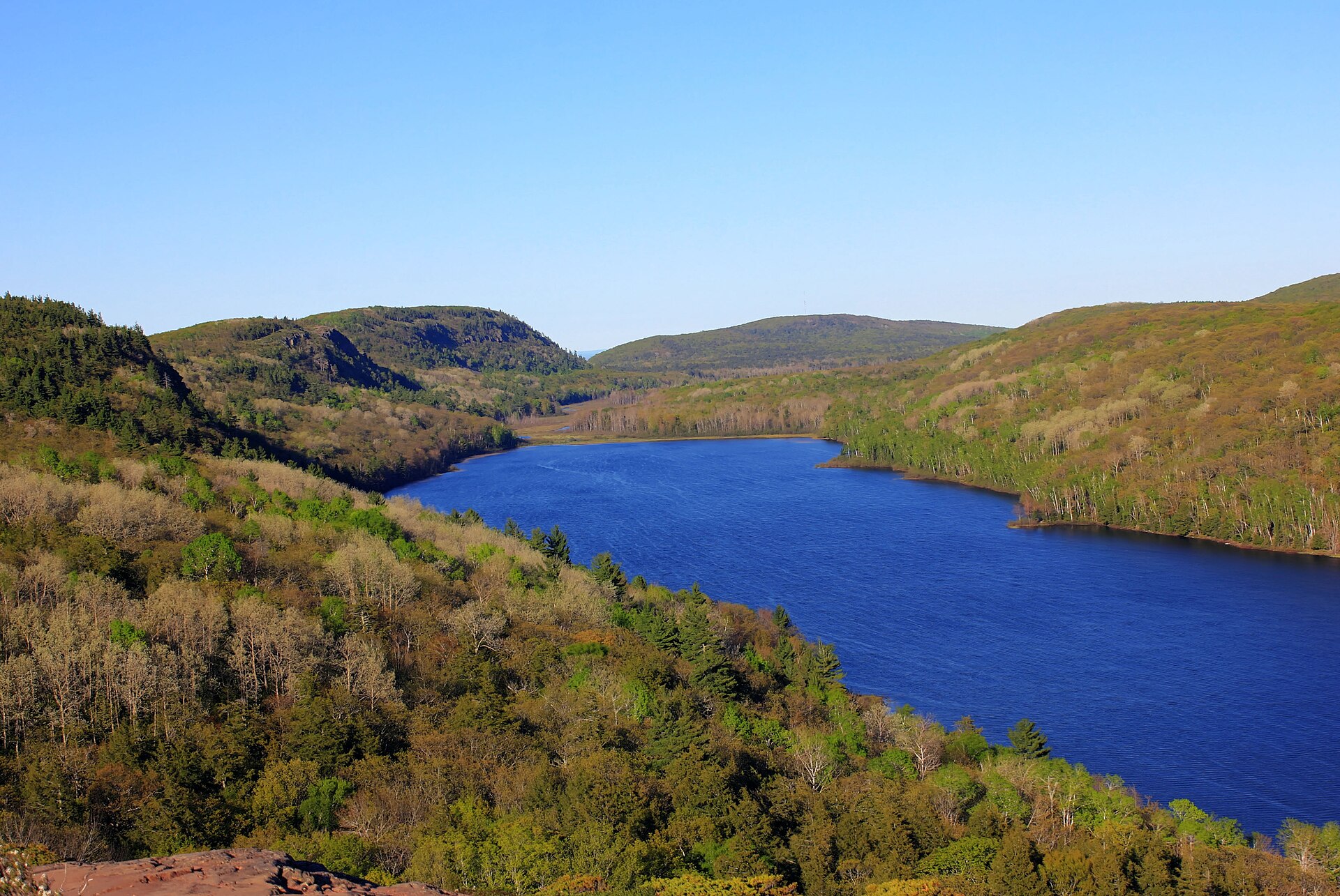
Starting at Ironwood puts a traveler in Big Snow Country, the lake-effect belt that receives on the order of two hundred inches a season. East and north of it, the route runs toward the Porcupine Mountains — the largest tract of old-growth northern hardwood forest remaining in the Midwest and the closest thing Michigan has to genuine wilderness mountains, with escarpment views over Lake of the Clouds that rank among the state's finest.
From Silver City and Ontonagon the tour continues toward the Keweenaw Peninsula, where it overlaps with the Copper Country Trail and the M-26 shore road through Eagle River and Eagle Harbor. This is the most attraction-dense portion of the Michigan route: the Quincy Mine, Calumet, the Delaware Mine, Brockway Mountain, Fort Wilkins, and Copper Harbor all sit within or just off the corridor. Travelers with limited time should weight their trip heavily toward this section.
The Central Coast: Marquette and Pictured Rocks
East of the Keweenaw the route runs through Marquette, the largest city in the Upper Peninsula and the only place on the entire Michigan portion with genuinely full urban services. Presque Isle Park, Sugarloaf Mountain, and the 1932 Lower Harbor ore dock all sit within minutes of the highway, and the city is the natural resupply and overnight point for anyone driving the full tour.
Continuing east, the corridor reaches Munising and Pictured Rocks National Lakeshore — the sandstone cliffs that are the single most photographed feature on Lake Superior. Grand Marais anchors the lakeshore's quieter eastern end with the Grand Sable Dunes, Sable Falls, and the Log Slide, reached via M-77. This central stretch holds the highest concentration of nationally significant scenery on the Michigan route.
The Eastern End: Tahquamenon and Whitefish Bay
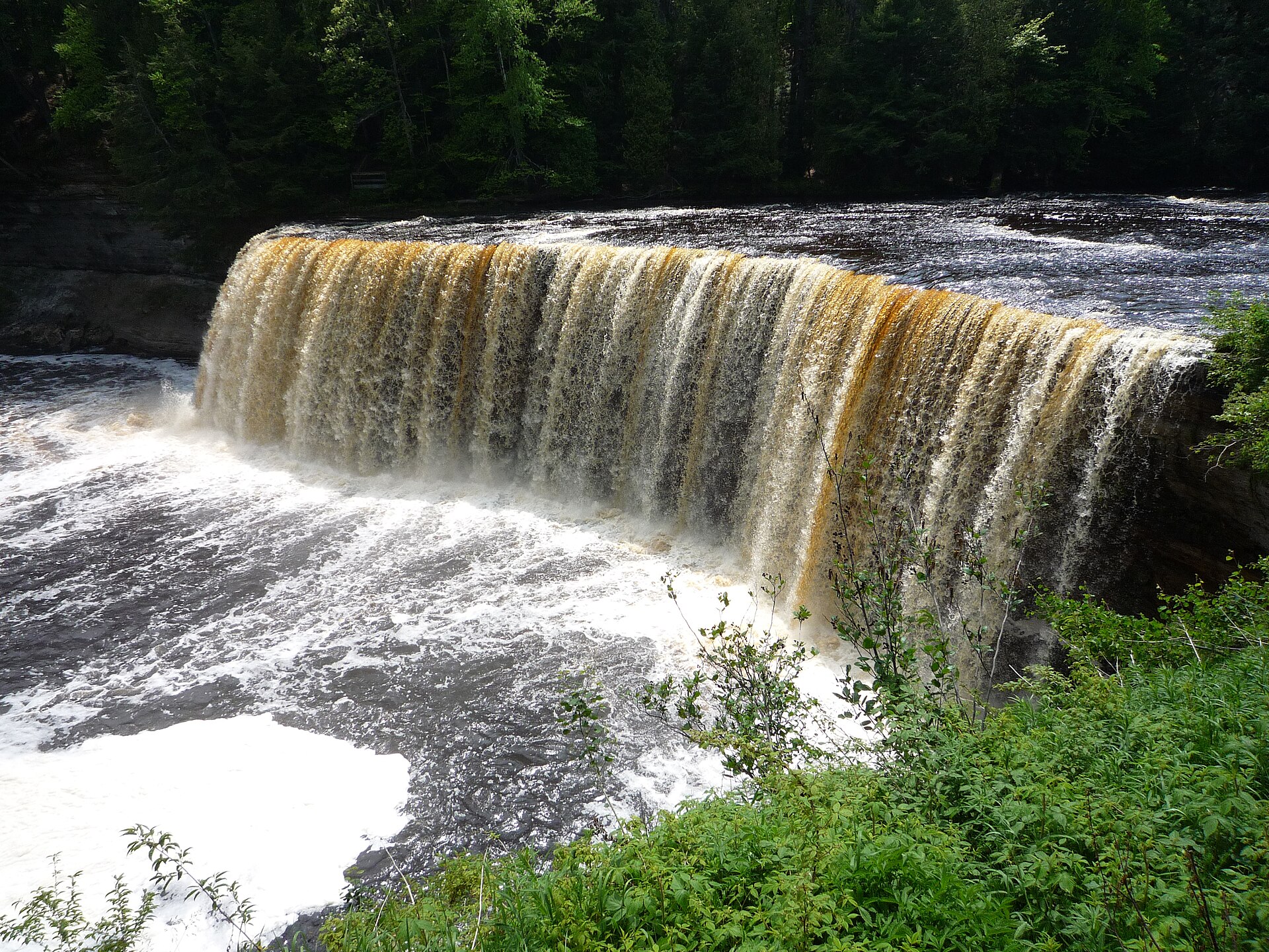
The eastern Upper Peninsula brings the route inland and back to the water repeatedly. M-123 loops north toward Paradise and Whitefish Point, where the Great Lakes Shipwreck Museum interprets the deadliest water on the lake, and passes Tahquamenon Falls — among the largest waterfalls east of the Mississippi and the most-visited natural attraction in this half of the peninsula.
From there the tour follows the Whitefish Bay shoreline past Point Iroquois Lighthouse and Brimley toward Sault Ste. Marie, where the Soo Locks lift vessels the roughly twenty-one feet between Lake Superior and the lower St. Marys River. Finishing at the locks is fitting: after 516 miles along the lake, a traveler ends at the single point through which everything entering or leaving Superior must pass.
Planning and Practicalities
Five hundred and sixteen miles sounds manageable and is not, because the driving is slow and the stops are the point. A week is the realistic minimum for the Michigan portion alone, and ten days allows the Porcupine Mountains, the Keweenaw, Pictured Rocks, and Tahquamenon to each get the day they deserve. Attempting it in a long weekend produces a driving marathon with a few photographs.
Fuel discipline matters more here than anywhere else in the state. Services cluster in towns and vanish between them, particularly across the western Upper Peninsula, and the habit to build is filling up in every town regardless of gauge reading. Summer through early October is the practical season; winter closes much of the tourist infrastructure and turns the route into a serious undertaking, though the highways are maintained and driven year-round by people who live there. Black flies in early summer are a genuine consideration on the western half.