In This Guide
Houghton, Hancock, and the Lift Bridge The Quincy Mine Keweenaw National Historical Park Calumet North Toward the Tip Brockway Mountain and Copper Harbor Driving the BywayBetween 1840 and 1968, the Keweenaw Peninsula produced more than eleven billion pounds of copper. That single number explains the entire landscape a traveler drives through on the Copper Country Trail — the shaft houses standing in the woods, the outsized theatre in a village of two thousand people, the rock piles, the company towns, and the sheer improbability of that much industry at the far end of a peninsula reaching into Lake Superior. The byway is a 47-mile run of US-41 from the Portage Lake Lift Bridge between Houghton and Hancock north to Copper Harbor, where the highway simply ends. It was designated a Michigan State Heritage Route in 1994 and joined the national America's Byways collection in 2005, and it is the most concentrated stretch of industrial history in the state.
Houghton, Hancock, and the Lift Bridge
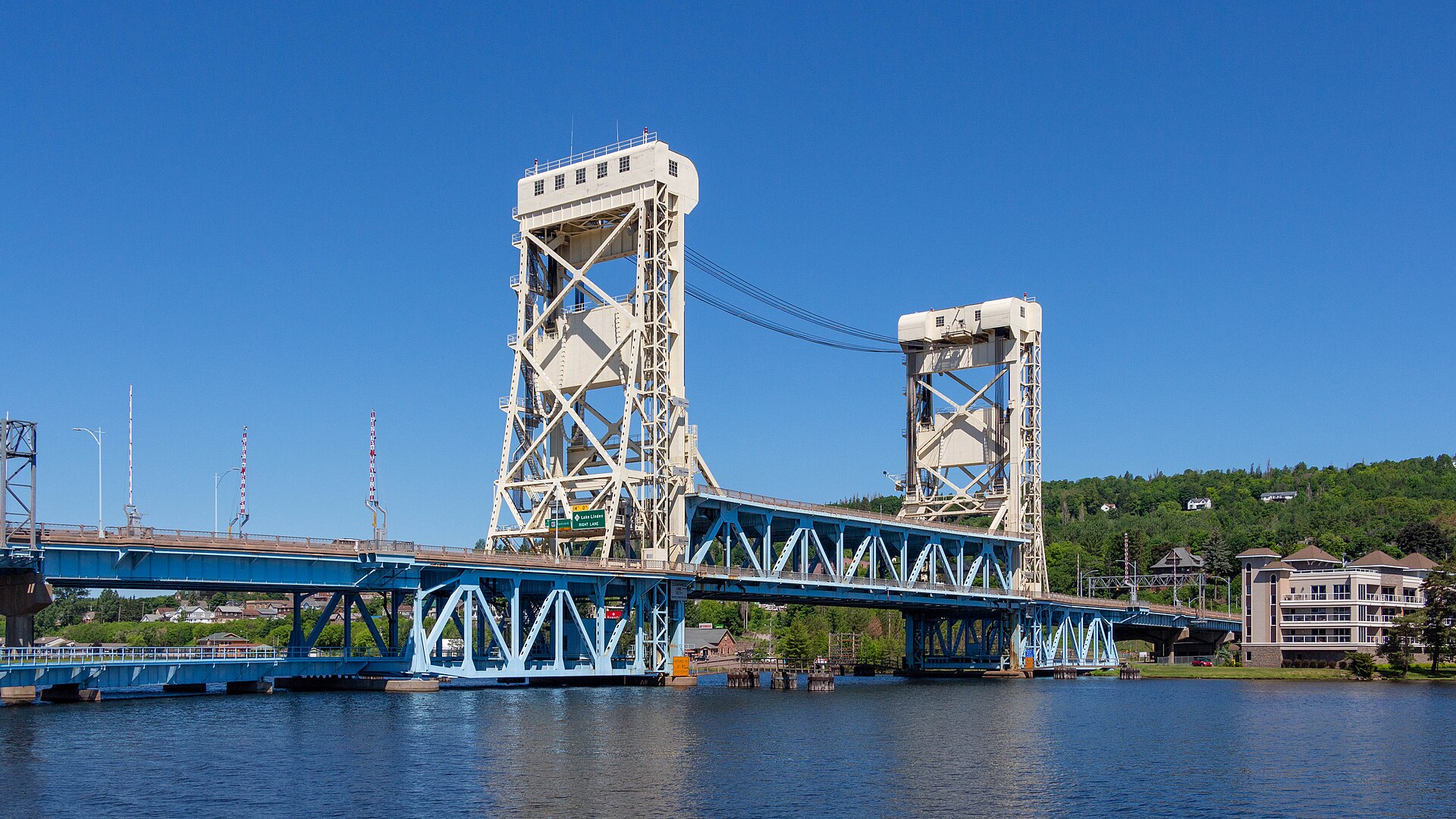
The byway begins at the Portage Lake Lift Bridge, the span connecting Houghton on the south shore to Hancock on the north across the Portage Lake waterway that effectively cuts the Keweenaw in two. The bridge is the practical gateway to the upper peninsula-within-a-peninsula, and the twin cities on either side form the region's population and service center — the last place with a full range of groceries, fuel, and lodging before the road narrows toward the tip.
Both towns climb steeply from the water, which gives them an unusual vertical character for Michigan and some genuinely alarming winter streets. Michigan Technological University sits in Houghton and keeps the area busier and younger than a former mining district would otherwise be. Travelers should treat this as the staging point: fuel here, buy what the trip needs here, and understand that services thin sharply within twenty miles.
The Quincy Mine
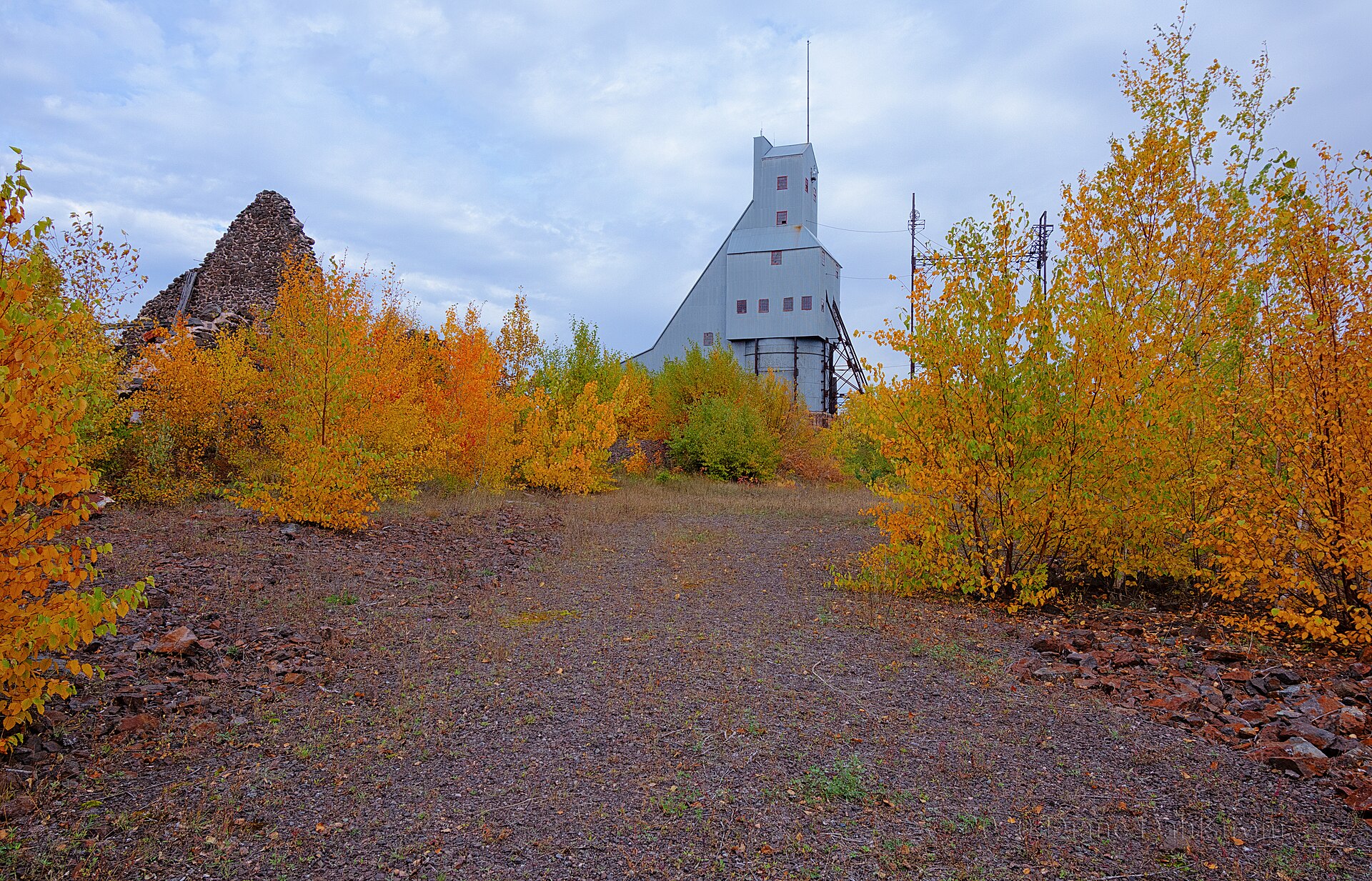
Immediately northeast of Hancock, the Quincy Mine dominates the skyline with its shaft-rock house standing above the highway — the single most recognizable structure on the byway. The Quincy Mining Company was established in 1846, and the site now forms the Quincy Unit of Keweenaw National Historical Park, preserving the remnant structures and workings that illustrate how copper was actually extracted and processed here.
The visit worth making is the full one. A cog rail tram descends the steep hillside toward the water, and underground tours take visitors into the mine itself, which conveys the conditions of the work in a way that surface exhibits cannot. Between the hoist house, the tram, and the underground portion, this absorbs several hours and is the strongest single stop on the entire route for understanding what the copper boom actually involved.
Keweenaw National Historical Park
The park is an unusual institution and worth understanding before visiting, because it does not behave like a conventional national park. Established on October 27, 1992, it is a federal–local cooperative made up of two primary units — Quincy, above Hancock, and Calumet, further north — plus nearly two dozen cooperating Heritage Sites on federal, state, and private land scattered across the peninsula. There is no single gate, no single admission, and no single visitor center covering everything.
In practice that means a traveler assembles their own itinerary from the Heritage Site partners rather than following one loop. Nineteen official partners help tell the region's mining story, and they range from substantial museums to small local collections. The upside is genuine variety and local texture; the downside is that hours vary widely and seasonally, so checking ahead for the specific sites on a planned route saves real frustration.
Calumet
Calumet is the emotional center of the drive. The Calumet Unit of the national historical park preserves buildings and sites associated with the Calumet & Hecla Copper Mining Company, which at its height made this one of the wealthiest places per capita in the country — and the architecture still says so. The Calumet Theatre, built when the copper money was at flood tide, is an opera house of a scale and finish that makes no sense in a village this size until the history is understood.
Heritage Sites clustered here include the Coppertown Mining Museum, the Keweenaw Heritage Center, and the Copper Country Firefighters History Museum, which together fill a substantial part of a day. Walking the downtown is the other half of the experience: the commercial blocks are largely intact, built in sandstone by a company that expected the boom to last, and the gap between that ambition and the present population is the most affecting thing on the byway.
North Toward the Tip
North of Calumet the settlements thin — Ahmeek, Mohawk, and the smaller places along the highway — and the forest closes in around the road, producing long stretches of canopy overhead. Near Mohawk, the Delaware Mine offers a self-guided tour descending Shaft No. 1 to the first level at 110 feet, where veins of native copper are visible in the walls. Michigan's copper occurred as metal rather than ore requiring smelting, and seeing that directly explains the entire nineteenth-century rush better than any exhibit panel.
This is also where the byway offers a choice. US-41 continues directly toward Copper Harbor, while M-26 branches west to the Lake Superior shore through Eagle River and Eagle Harbor — past Jacob's Falls, visible from the road, and the Jampot bakery run by the Brothers of the St. John Monastery, and along the high sandy bluff known as the Sand Dune Drive. Most travelers should take M-26 north and US-41 south, or the reverse, so as to drive both.
Brockway Mountain and Copper Harbor
Brockway Mountain Drive is the scenic payoff. A Works Progress Administration project running roughly nine miles off M-26 between Eagle Harbor and Copper Harbor, it climbs the ridge to 1,320 feet — the highest above-sea-level drive between the Rockies and the Alleghenies, and some 720 feet above the surface of Lake Superior. The viewpoints take in Copper Harbor, the lake, and unbroken forest, and on a genuinely clear day Isle Royale is visible roughly fifty miles out. Sunset from the top is the standard evening plan for anyone staying nearby.
US-41 ends at Copper Harbor, and the village packs a remarkable amount into its last few miles of road: Fort Wilkins Historic State Park with its restored 1840s garrison buildings, the Copper Harbor Lighthouse complex reachable only by boat, the 570-acre Estivant Pines sanctuary protecting old-growth white pine over 125 feet tall and around three centuries old, and a mountain bike trail network rated a Silver-Level Ride Center by the International Mountain Bicycling Association. It is an improbable concentration for a village of a few dozen year-round residents.
Driving the Byway
Forty-seven miles is nothing as a drive and everything as a trip. A traveler could cover the byway in ninety minutes and see essentially none of it; two full days is the realistic minimum to include Quincy, Calumet, the Delaware Mine, and the tip, and three days allows the M-26 shore route and Estivant Pines without compressing anything. Basing in Houghton or Hancock at the south end and Copper Harbor at the north, with one night at each, is the natural shape.
Season governs hard here. Summer through early autumn is when the mines, museums, and Heritage Sites operate, and late September brings hardwood color across the peninsula with the crowds already thinning. Winter closes most of the interpretive infrastructure and much of Copper Harbor entirely — this is among the snowiest country in the eastern United States — though the byway itself stays open and the landscape under snow is genuinely spectacular for travelers equipped and willing. Whatever the season, check individual site hours before building a day around them; the cooperative structure means they do not all keep the same calendar.