In This Guide
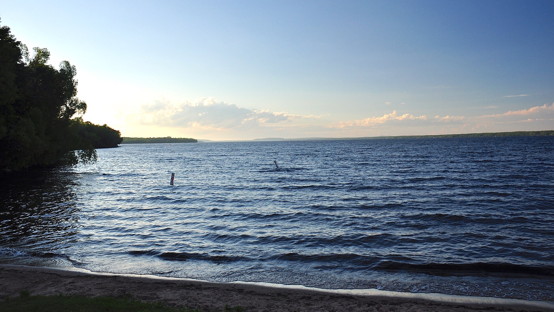
A Big Lake With a Shallow Heart Lake Gogebic State Park Bergland, Marenisco, and the Roads Around the Lake Waterfalls Within an Easy Drive Winter, Summer, and Planning Your StayTucked into the vast green quilt of the Ottawa National Forest, Lake Gogebic is the largest natural inland lake in Michigan's Upper Peninsula, a long, fertile sweep of water straddling Gogebic and Ontonagon counties in the far western U.P. Its name is pronounced goh-GHEE-bik or goh-GHIB-ik depending on whom you ask, and locals cheerfully accept either. The lake is so long that it spans two time zones, with the line between Central and Eastern time crossing its western shore at the county boundary. Surrounded by hardwoods and pine, sprinkled with resorts and cabins, and anchored by the tiny community of Bergland at its northern tip, it remains one of the quieter big-water destinations in the state. Anglers know it for walleye and jumbo perch, snowmobilers know it as a winter crossroads, and families know it as a place where a week can pass without a traffic light. This guide gathers the essentials for planning a visit in any season.
A Big Lake With a Shallow Heart
Measured against its reputation, Lake Gogebic is surprisingly modest in depth. Most sources put its surface at roughly thirteen thousand acres, though estimates vary, and accounts of its length range from about a dozen miles to nineteen depending on the source, as a Mining Gazette profile of the lake illustrates. Maximum depths reach only into the mid-to-upper thirties of feet, and much of the basin is far shallower, which helps the water warm quickly in summer. Although the lake is natural, its level is regulated by the Upper Peninsula Power Company through the Bergland Dam downstream on the West Branch of the Ontonagon River, a detail noted in the Wikipedia entry for Lake Gogebic. The result is a broad, productive lake that can shift from glassy calm to whitecaps within an hour. Boaters should respect that temperament, because the long open stretches give a steady wind plenty of room to build waves.
That shallow, nutrient-rich water is exactly what makes the fishing so good. A 2005 Department of Natural Resources survey recorded walleye, yellow perch, northern pike, smallmouth bass, black crappie, rock bass, cisco, and burbot among the lake's residents, and Northland Tackle's lake profile reports that walleye made up roughly three-quarters of the fish collected. Perch fishing has become something of a winter religion here, with anglers chasing jumbo fish over the mid-lake mud flats where mayfly larvae emerge, as the Lake Gogebic Area Chamber explains. Special size and bag rules have applied to both species over the years, so always check the current Michigan fishing regulations before keeping fish. Local resorts and bait shops are reliable sources of up-to-date advice, and a guided outing is the fastest way to learn the lake's reefs and flats. Even a novice can spend a happy evening drifting the weed edges as the sun sinks behind the pines.
Lake Gogebic State Park
On the lake's western shore, Lake Gogebic State Park offers the easiest public access to the water and one of the most pleasant campgrounds in the western U.P. The park covers about 360 acres along M-64, with nearly a mile of beach frontage, a boat launch, picnic grounds, and a two-mile nature trail that wanders into the surrounding national forest, as summarized by Wikipedia's park entry. Its history reaches back to 1926, when Gogebic County purchased lakeshore land and gave it to the state, with further donations following before the park opened in 1930. A curious footnote adds a touch of mystery: in 1962, two old gravestones engraved with the years 1822 and 1824 were discovered on the grounds, believed by researchers to mark fur traders of that early era. Campers wake to the slap of small waves on the beach and fall asleep to the rustle of birch leaves. It is an ideal base for families who want swimming, fishing, and hiking within a few steps of the tent.
The park also makes a convenient launch point for exploring the lake by boat or kayak. Calm mornings are the best time to paddle the western shoreline, before afternoon winds build across the open water, and the Michigan state park reservation system lets you book campsites months in advance for popular summer weekends. Because the park sits in Gogebic County, it keeps Central time, while Bergland and the northern end of the lake keep Eastern time, a small detail worth remembering when you plan check-in times and dinner reservations. Services right at the lake are limited, so stock up in the larger towns to the west, an easy errand covered in our Wakefield and Bessemer guide. Vehicle entry to Michigan state parks requires a Recreation Passport, which residents can add when renewing a license plate and visitors can purchase at the park. With those logistics settled, the lake's slow rhythm takes over quickly.
Bergland, Marenisco, and the Roads Around the Lake
The roads around the lake form a loose ring that is a pleasure to drive in any season. M-64 runs north from Marenisco toward the lake's southern end, follows the western shore past the state park and across the county line, then merges with M-28 at Merriweather and continues to Bergland at the northern tip. From there M-28 leads east toward Bruce Crossing and west toward Wakefield, while M-64 strikes north through dense forest to Silver City and the shore of Lake Superior. Bergland is home to only about 140 people, and Marenisco to fewer than two hundred, so these are places to pause rather than to shop. The stretch of M-28 along the lake is part of the Lake Superior Circle Tour, which explains the occasional out-of-state license plate. Fall color along these routes usually peaks from late September into early October, when maples blaze against the dark water.
Marenisco takes its unusual name from Mary Enid Scott, wife of a timber producer; the first three letters of each of her names were stitched together to form the town's moniker, according to its Wikipedia entry. That logging heritage runs throughout the region: the Ottawa National Forest was established in 1931 after decades of cutting had stripped away much of the old-growth pine, and today it covers nearly a million acres across the western U.P. The Forest Service's Ottawa National Forest recreation listings detail campgrounds, boat launches, and trails scattered throughout the area, many within a short drive of the lake. U.S. 2 runs just south of Lake Gogebic, linking the area with Watersmeet and the Sylvania Wilderness to the east and with Ironwood to the west. Even a brief detour off the highway can lead to a silent forest lake without another car in sight. That spacious solitude is the true currency of this corner of Michigan.
Waterfalls Within an Easy Drive
Some of the western Upper Peninsula's finest waterfalls lie within an hour of the lake. East along M-28, about seven miles southeast of Bruce Crossing, Agate Falls Scenic Site drops about thirty-nine feet over a shelf of erosion-resistant sandstone on the Middle Branch of the Ontonagon River. A half-mile trail leads to an accessible observation platform above the crest, passing through a tunnel beneath the highway, and an old Duluth, South Shore and Atlantic railroad trestle spans the river overhead, as the Michigan DNR's Agate Falls page describes. That trestle now carries a snowmobile and ATV trail, a fine example of the region's knack for repurposing its industrial bones. It is the sort of place where an intended five-minute stop stretches into an hour of watching the water braid itself over the rock. Picnic tables at the adjacent roadside park make it an easy lunch break.
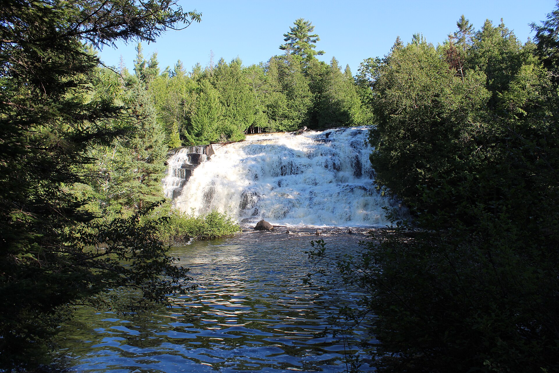
A little farther afield, Bond Falls near Paulding is one of the most photographed cascades in the Upper Peninsula, a broad, lacy curtain dropping about fifty feet on the same Middle Branch of the Ontonagon. Its flow is shaped in part by an upstream power company dam, but the scene is no less beautiful for it, and an accessible boardwalk with several viewing spots makes it suitable for nearly every visitor. The Copper Country tourism guide to Bond Falls describes the walkway that crosses the river below the base of the falls, and both the river and the Bond Falls Flowage above it are stocked with brook trout. Waterfall lovers with more time should continue north to the Porcupine Mountains, where the Presque Isle River tumbles through a series of falls on its way to Lake Superior. Combining two or three of these sites with a morning on Lake Gogebic makes for a memorable day of western U.P. scenery. Spring snowmelt brings the most dramatic flows, while October adds a frame of autumn color.
Winter, Summer, and Planning Your Stay
Winter transforms Lake Gogebic into a different kind of playground. The western U.P. sits in a heavy snow belt, with parts of the Ottawa National Forest receiving more than two hundred inches in some winters, according to Wikipedia's Ottawa National Forest article. Once the ice is safe, anglers head out over the perch flats on foot, snowmobile, and ORV, and resorts on the lake sponsor ice fishing tournaments alongside their summer contests. The Lake Gogebic Area Chamber describes the area as a snowmobile hub with seven trails in and out, connecting riders to the Upper Peninsula's thousands of miles of groomed routes. Ice conditions vary considerably from year to year and from bay to bay, so ask locally and never assume that a pressure ridge, inlet, or river mouth is safe. The reward for caution is a frozen landscape of startling beauty, glittering under a low northern sun.
Summer remains the high season, when cabins and resorts fill with families who return year after year. Arrive with groceries, insect repellent, and a paper map, since cellular coverage can be patchy in the national forest. The nearest full-service city is Ironwood, roughly forty minutes west of Bergland, and its attractions are covered in our Ironwood travel guide. For a broader road-trip framework, both the Lake Superior Circle Tour and U.S. Route 2 in Michigan pass close by. However you arrive, budget at least three days: one for the lake, one for the waterfalls, and one simply to sit on a dock and watch the light change. Lake Gogebic does not hurry anyone, and that is precisely its charm.