In This Guide
Eagle Harbor Light Station Jacob's Falls and the Jampot The Sand Dune Drive and Brockway MountainThe stretch of M-26 running along the Keweenaw Peninsula's northern shore between Eagle River and Eagle Harbor is, mile for mile, among the most concentrated collections of worthwhile stops in Michigan. In eight miles a traveler passes a waterfall visible from the pavement, a bakery run by monks, a high sandy bluff with Lake Superior filling the entire northern horizon, and an 1871 brick lighthouse that is the only light on the Keweenaw where visitors can tour the interior and climb the tower. None of it requires a hike, a ferry, or a reservation. It simply accumulates along the roadside, which makes this one of the rare Upper Peninsula itineraries that rewards travelers with limited time as generously as it rewards those with plenty.
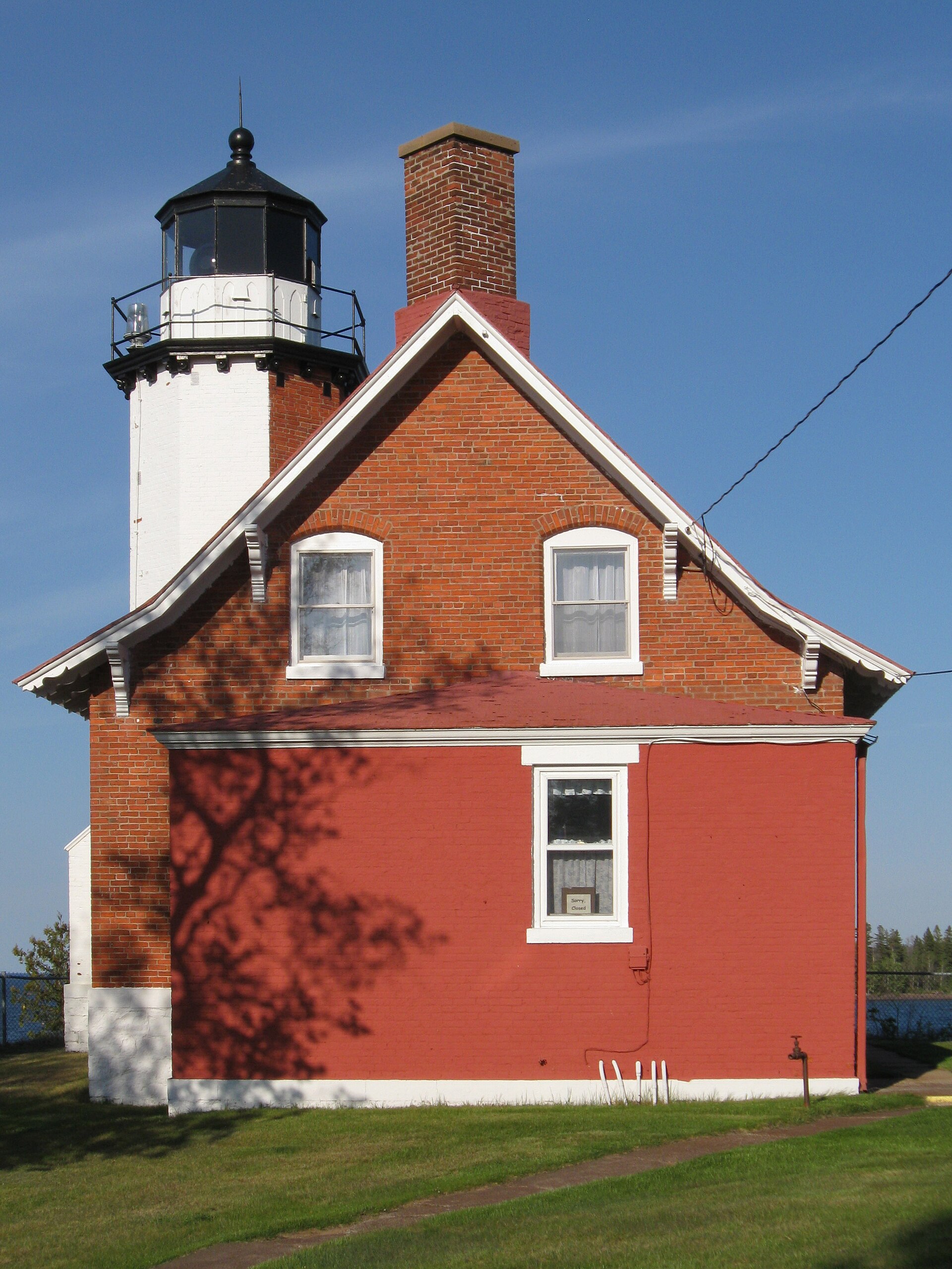
Eagle Harbor Light Station
The brick lighthouse at Eagle Harbor dates to 1871 and anchors a Light Station Museum Complex that is open to visitors through the summer months. Its distinction among Keweenaw lighthouses is meaningful: this is the only one on the peninsula where a visitor can take an interior tour and climb the tower for the view, which converts it from a photogenic exterior into an actual experience. The station sits on the harbor it was built to serve, and the arrangement of keeper's dwelling, tower, and outbuildings survives intact enough to convey how such a place functioned as a working household rather than merely as a navigational aid.
The harbor itself explains the light's existence. This is one of the few genuinely protected anchorages on the Keweenaw's exposed northern shore, and in the copper-boom decades it mattered enormously to vessels working a coast that offers very little shelter otherwise. Lake Superior's reputation for destroying ships was earned in large part along stretches like this one, and a light marking a reliable harbor entrance was the difference between refuge and disaster in a November gale. Standing on the shore in calm July weather, that reality takes some imagination — which is precisely why the museum is worth the time.
Jacob's Falls and the Jampot
About three miles out of Eagle River along M-26, Jacob's Falls comes into view directly from the road, requiring no hike whatsoever — an unusual convenience among Michigan waterfalls, most of which extract at least a short walk in payment. The falls tumble down a rock face immediately beside the highway, and the pullout gives an unobstructed view that makes this one of the most photographed roadside cascades in the Upper Peninsula.
Directly alongside sits the Jampot, a bakery operated by the Brothers of the St. John Monastery, and it has become a genuine destination in its own right rather than a novelty attached to the waterfall. The monks produce jams, preserves, and baked goods, and the operation's reputation extends well beyond the peninsula. Visitors should be aware that a monastic bakery keeps monastic hours and a seasonal schedule rather than the hours of a commercial storefront, so confirming before making a special trip is prudent. The combination — a waterfall and a monks' bakery within a few steps of each other on a remote Lake Superior highway — is the sort of thing that makes the Keweenaw difficult to summarize to people who have not been there.
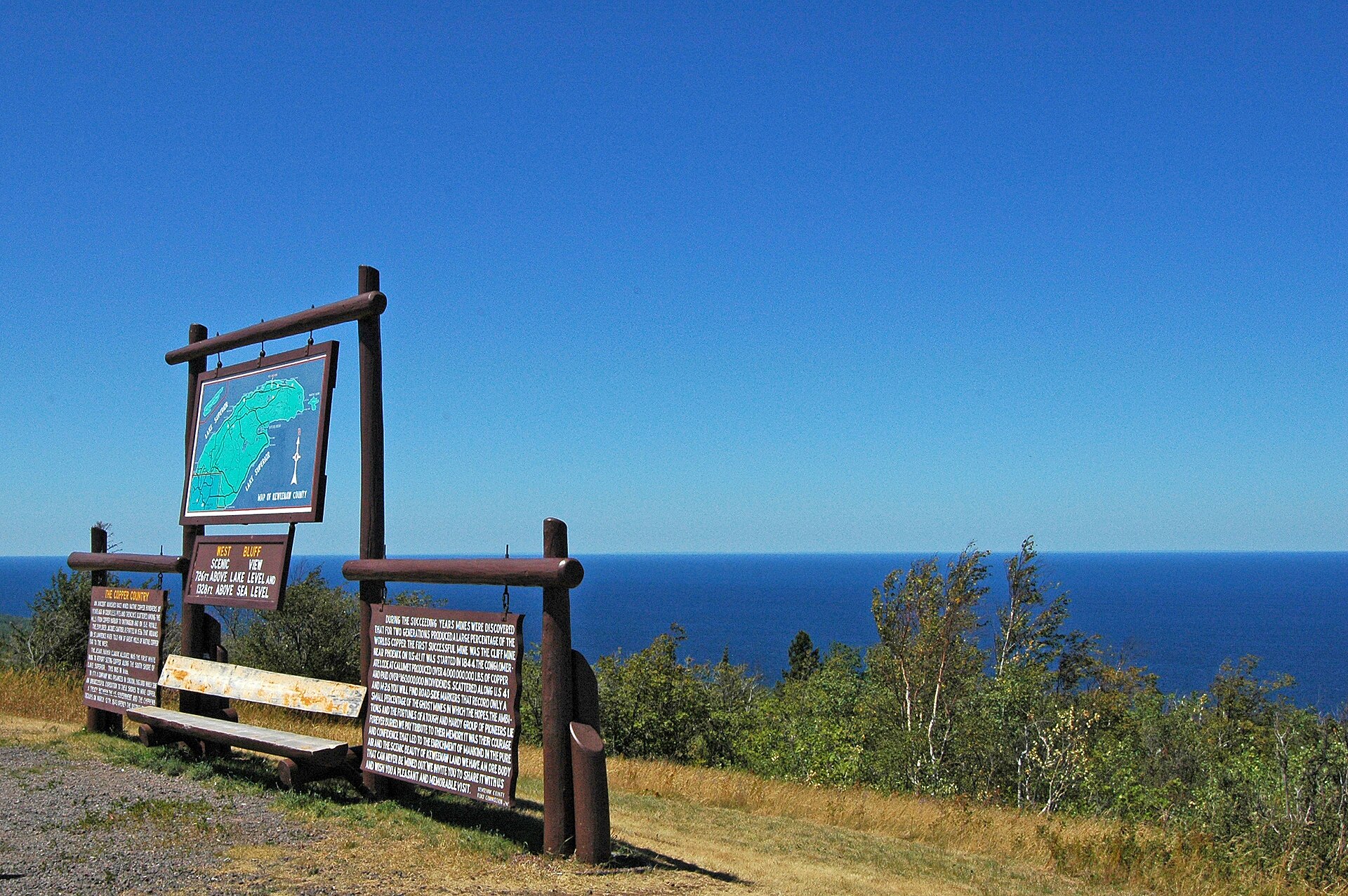
The Sand Dune Drive and Brockway Mountain
The eight-mile run between Eagle River and Eagle Harbor, carried high along a sandy bluff above the lake, is known as the Sand Dune Drive, and it delivers sustained open water views of a kind that most Great Lakes shoreline roads only offer in glimpses. There is no particular destination along it; the drive is the point. Travelers should allow more time than the mileage suggests, because the pullouts are frequent and the temptation to use all of them is difficult to resist, particularly in the late afternoon when the light comes across the water at a low angle.
East of Eagle Harbor, Brockway Mountain Drive climbs the ridge toward Copper Harbor and constitutes the region's signature scenic route. A Works Progress Administration project, it is the highest above-sea-level drive between the Rockies and the Alleghenies, topping out at 1,320 feet — some 720 feet above the surface of Lake Superior. The viewpoints along the ridge take in Copper Harbor, the lake, and an expanse of undeveloped woodland, and on a genuinely clear day Isle Royale is visible roughly fifty miles out. Pairing the Sand Dune Drive westbound with Brockway eastbound makes for a compact day that covers the Keweenaw's best road mileage without retracing much of it.