Whitefish Bay is the last sheltered water a westbound vessel sees before committing to open Lake Superior, and the byway tracing its southern shore runs through some of the quietest country in the eastern Upper Peninsula. The Whitefish Bay National Forest Scenic Byway covers a little over 27 miles through the Hiawatha National Forest between Brimley State Park and M-123 outside Paradise, designated in 1989 and following the Lake Superior shoreline through birch and pine. It connects two of the region's more significant maritime sites at either end, and almost nothing in between except forest and water.
The Route End to End
The byway runs 27.1 miles, with its eastern end at Lakeshore Drive in Bay Mills Township near Brimley State Park and its western end at M-123 in Whitefish Township outside Paradise. The designation dates to 1989, and the road runs through Hiawatha National Forest land for essentially its entire length, which is why development along it is close to nonexistent.
Driving it takes under an hour without stops and considerably longer with them, which is the correct approach. The road holds close to the Lake Superior shore through much of its run, with pullouts and beach access points that see very little use even in summer. This is the sort of route where a traveler can reasonably expect to have a stretch of Great Lakes beach entirely to themselves on a July afternoon.
The Brimley End
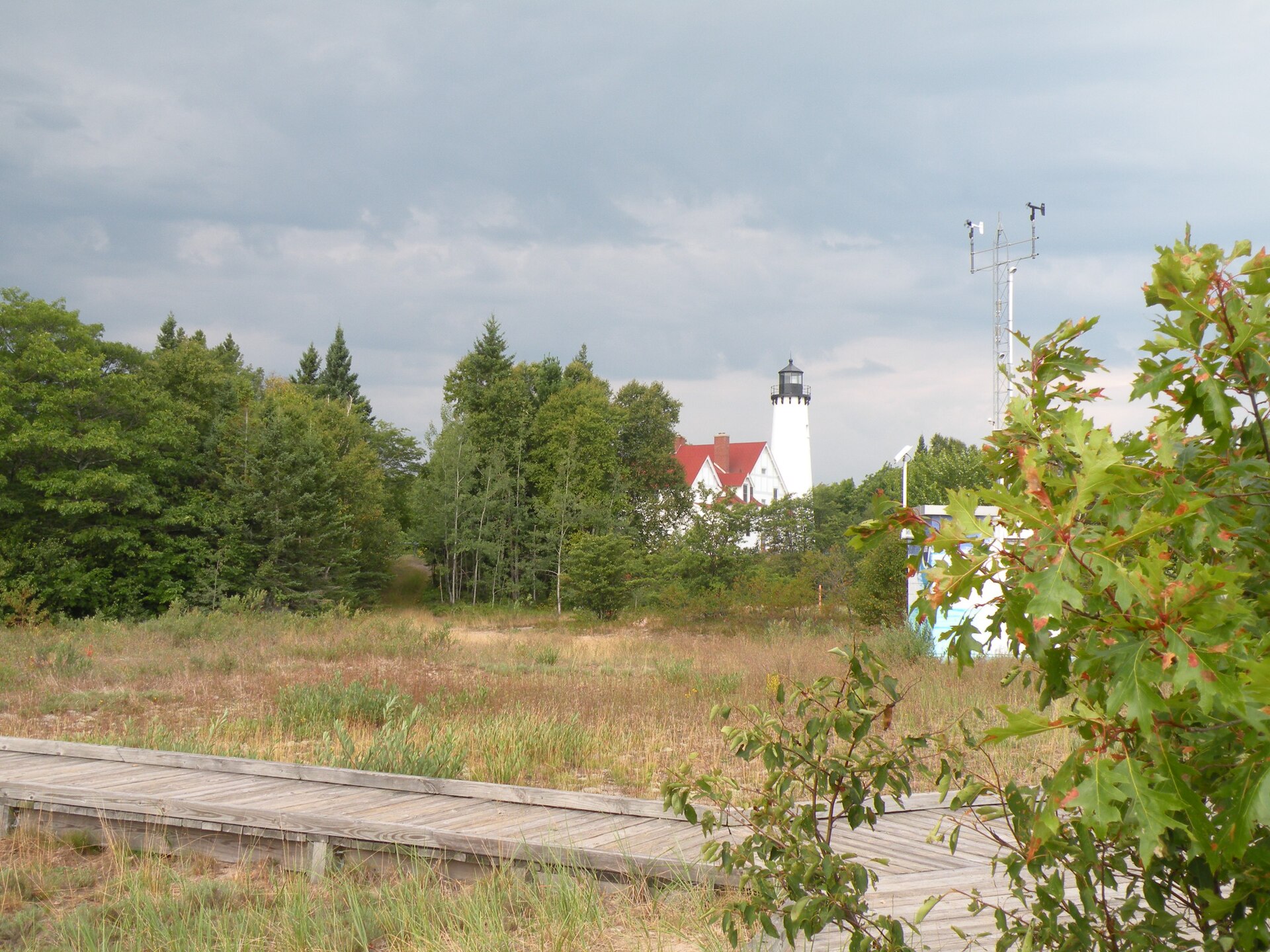
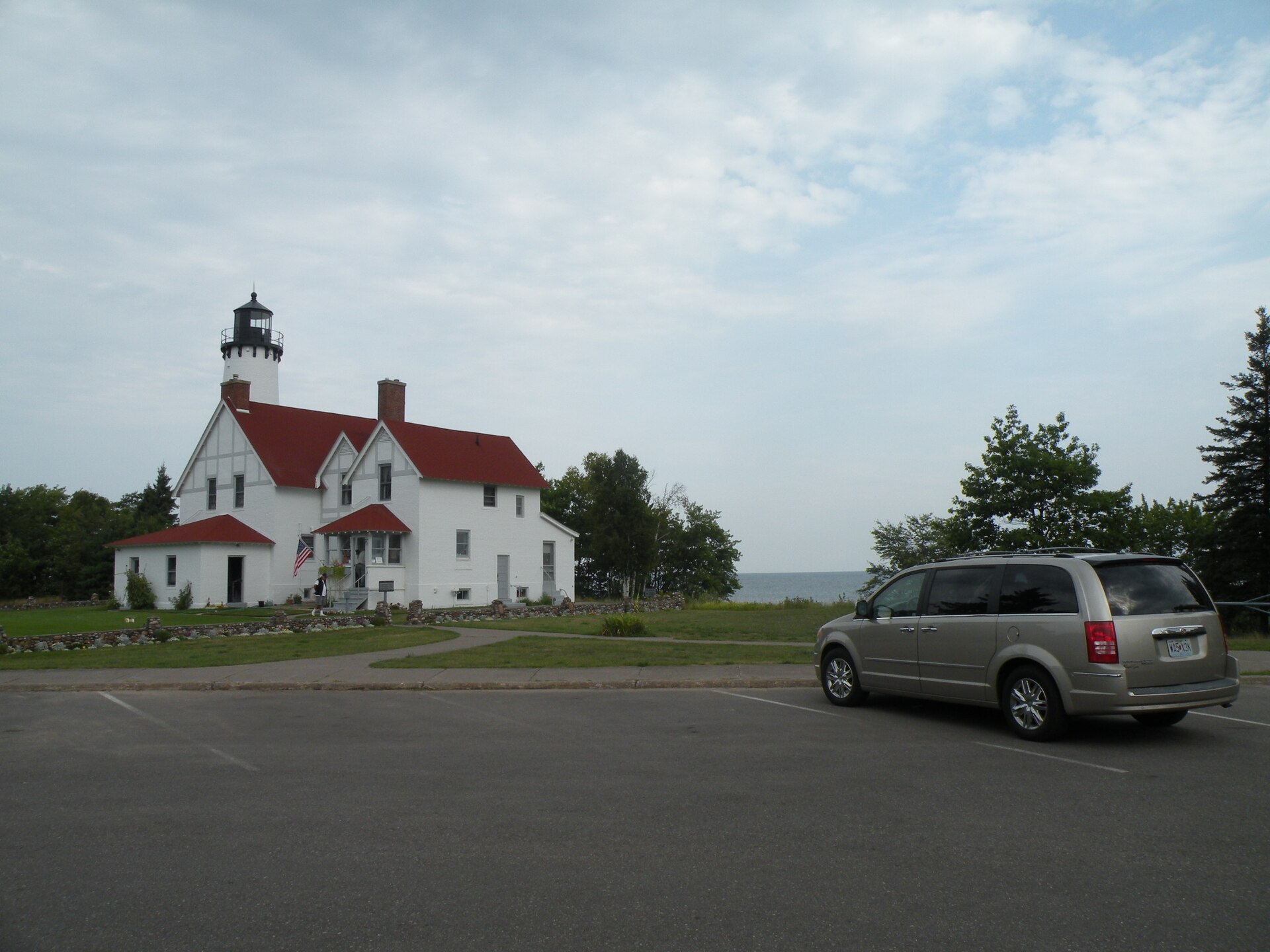
Starting from the east puts Point Iroquois Lighthouse early in the drive. The 1870 tower stands 65 feet above the point marking the division between Whitefish Bay and the western end of the St. Marys River — the connection linking Lake Superior to the rest of the Great Lakes. It is free to enter, visitors can climb the 72 steps to the top, and the museum occupies the renovated keeper's quarters. The Coast Guard decommissioned it in 1962 and the Hiawatha National Forest took over management in 1965, which is why it survives.
The point's name records a considerably darker history: Iroquois warriors were killed here by the Ojibwe in 1662, in a conflict that shaped control of the upper Great Lakes for generations. Brimley State Park sits nearby and provides the area's most straightforward shoreline access and camping, with water warm enough for swimming thanks to the bay's shallow, sheltered geometry — a genuine surprise to anyone who associates Lake Superior only with cold.
The Paradise End
The western terminus at M-123 near Paradise opens onto the eastern Upper Peninsula's two headline attractions. North on M-123 leads to Whitefish Point and the Great Lakes Shipwreck Museum, a National Historic Site interpreting the wrecks in what is among the deadliest water on the lake — the stretch that gives Whitefish Point its reputation. South and west on M-123 reaches Tahquamenon Falls, among the largest waterfalls east of the Mississippi.
That positioning is what makes the byway more than a pleasant drive. It functions as the connector between the Soo and the Tahquamenon–Whitefish Point country, and taking it instead of the faster inland route costs very little time while replacing highway with shoreline. Travelers moving between Sault Ste. Marie and Paradise have no good reason to use anything else.
Practical Notes
Services along the byway itself are essentially nil — this is national forest land, and the towns are at the ends. Fuel and provisions should be handled in Brimley, Sault Ste. Marie, or Paradise rather than assumed to be available in between. Cell coverage is patchy through the forest sections.
Autumn is the standout season, with hardwood color through the forest and the bay at its calmest; summer offers the warm swimming that distinguishes Whitefish Bay from the open lake; winter brings serious lake-effect snow and a road that, while maintained, demands respect. For visitors basing in the Soo, this makes an easy half-day outing with Point Iroquois and Brimley State Park as the anchors, and it pairs naturally with a Tahquamenon or Whitefish Point day at the far end.