In This Guide
Turnip Rock Broken Rocks, Sea Caves, and Table Rock Grindstone City and the Working Shoreline Planning a Thumb WeekendMichigan's Thumb ends at Port Austin, and the water just offshore holds the most photographed rock formation in the state — a limestone pillar eroded into a shape so improbably top-heavy that first-time viewers tend to assume the picture has been manipulated. Turnip Rock is counted among the Seven Natural Wonders of Michigan, and its defining characteristic, for visitors, is that there is no road to it and no trail to it. The shoreline it stands on is private. The only honest way to see it is from the water, which means the trip is a seven-mile round-trip paddle or a boat tour, and that requirement filters the crowds in a way that has preserved both the formation and the experience of reaching it.
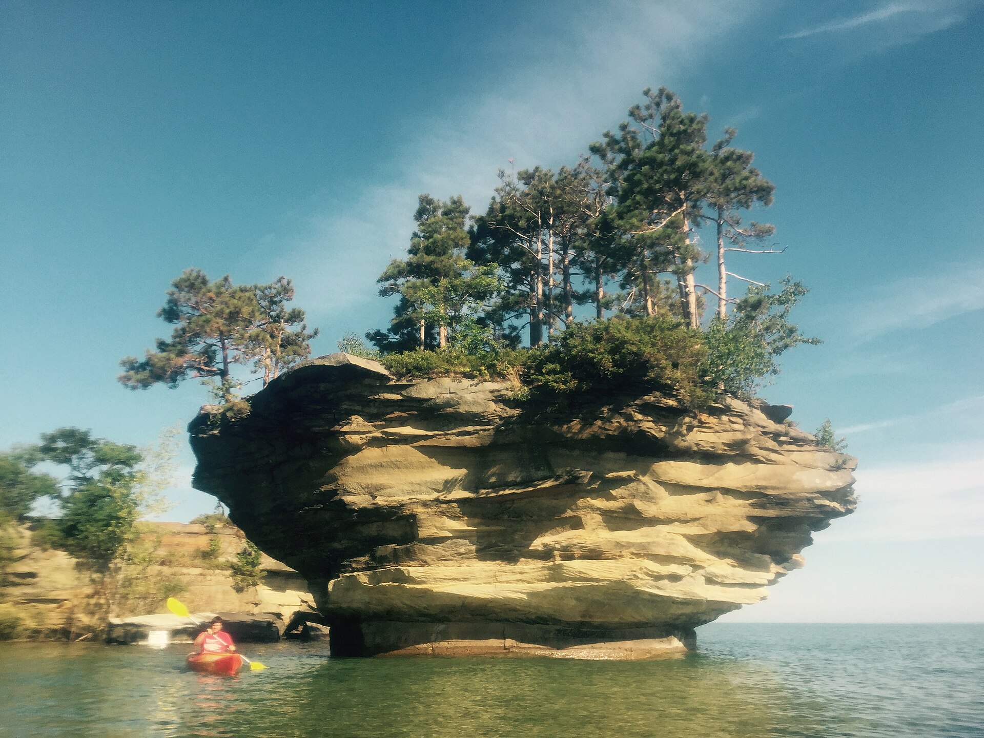
Turnip Rock
Centuries of wave action have undercut the soft limestone at the base of Turnip Rock far faster than the harder cap above it, producing a pillar that appears to balance on a stem barely capable of supporting it. The effect is genuinely startling in person, and it explains the formation's inclusion among the Seven Natural Wonders of Michigan. The rock sits just off Point aux Barques at the very tip of the Thumb, in shallow, clear water that on a calm summer morning takes on a Caribbean cast entirely at odds with expectations of Lake Huron.
Reaching it is a seven-mile out-and-back paddle following the Point aux Barques shoreline, and that distance deserves respect rather than casual dismissal. The route is beautiful and the water is shallow, but Lake Huron is still a Great Lake — wind can rise quickly, and an offshore breeze on the return leg turns a pleasant outing into genuine work. Most paddlers allocate the better part of a day. Outfitters in Port Austin rent kayaks and run guided trips for those who would rather not gamble on their own judgment, and boat tours serve visitors who want the view without the mileage. Landing on the rock itself is not permitted; the surrounding shore is private property, and respecting that boundary is the price of the formation staying accessible at all.
Broken Rocks, Sea Caves, and Table Rock
Turnip Rock is the headline, but the shoreline around Port Austin is riddled with formations that reward exploration on their own terms. The Broken Rocks Trail is a beginner-friendly paddling route running past rock formations and sea caves to Table Rock, a flat-topped formation where paddlers can pull up, swim, and eat lunch before turning back. The whole circuit can be completed in under three hours, which makes it the sensible choice for families, for less experienced paddlers, or for anyone whose schedule cannot absorb the full Turnip Rock commitment.
The geology behind all of it is the same: soft limestone, shallow water, and a few thousand years of wave energy working at the weakest seams. Sea caves along this shoreline are modest in scale compared with the sandstone theatrics of Pictured Rocks, but they are genuinely navigable by kayak in calm conditions and considerably more intimate. The clarity of the water here is the other surprise — the Thumb's eastern shore lacks the river-borne sediment that clouds much of Lake Huron's coast, and on a still day the bottom is visible well offshore.
Grindstone City and the Working Shoreline
Roughly five miles east of Port Austin, Grindstone City occupies a stretch of Lake Huron shore whose name is a plain description of what happened there. The local sandstone proved exceptionally well suited to grinding wheels, and the community shipped them in volume until synthetic abrasives destroyed the market — leaving behind a shoreline where discarded grindstones still lie about, some of them large enough that moving them was never worth anyone's effort. It is an unusually tangible piece of industrial archaeology, sitting in the open where visitors can walk up and put a hand on it.
For paddlers, Grindstone City County Park offers a sheltered marina launch that serves as the practical alternative to putting in at Port Austin, and it shortens the approach to some of the eastern shoreline routes. The surrounding area retains the character of a working coast rather than a resort strip: modest, unpolished, and considerably quieter than Michigan's western shoreline towns at the same latitude. Travelers who find Lake Michigan's beach towns overrun in July should treat the Thumb as the state's most underused coastline.
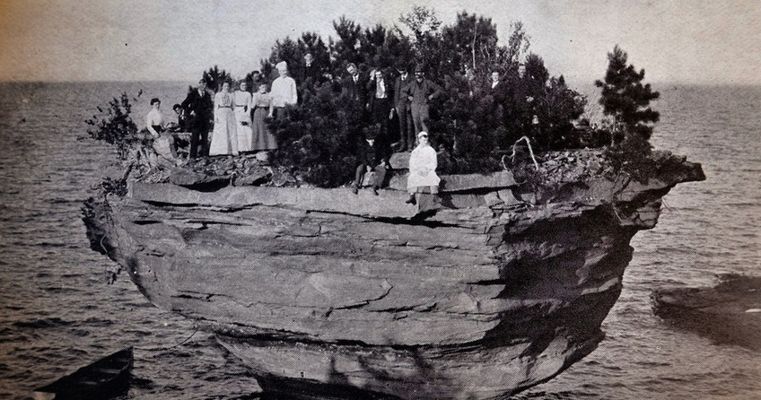
Planning a Thumb Weekend
Port Austin sits at the junction of the Thumb's two shorelines, which makes it the natural base for exploring both. Lodging runs to small inns, cottages, and rentals rather than chain properties, and summer weekends — particularly those with reliable weather — book up in a way that catches unprepared visitors off guard. The town supports a farmers market, a modest dining scene, and the outfitters that make the water accessible, but provisioning for a longer stay is more reliably handled in Bad Axe or before leaving the Interstate corridor entirely.
The single most important planning variable is wind. Every marquee attraction here is on open water, and a forecast that looks merely breezy on land can make the Point aux Barques paddle inadvisable or genuinely dangerous. Checking a marine forecast rather than a general one, and building flexibility into which day the big paddle happens, is the difference between a trip that delivers and one that spends three days looking at whitecaps. Early morning consistently offers the calmest water and the best light on the rock, which conveniently aligns the safest conditions with the most photogenic ones.