In This Guide
Port Huron and the Southern Start The Lake Huron Shore Around the Tip: Port Austin and Grindstone City The Saginaw Bay Side Driving the Arc Why the Thumb Over the West CoastMichigan's Thumb has one road that matters, and it traces the whole outline. M-25 runs roughly 150 miles from Port Huron at the base of the Blue Water Bridge north along the Lake Huron shore, around the tip of the Thumb, and back down the Saginaw Bay side to Bay City — an arc rather than a line, hugging the water for essentially its entire length and forming part of the Lake Huron Circle Tour the whole way. The route's defining feature is that the two halves are genuinely different: the eastern Lake Huron side is rockier, more exposed, and lined with lighthouses, while the Saginaw Bay side is sugar sand and calm shallow water. Driving the full arc means experiencing both in a single day.
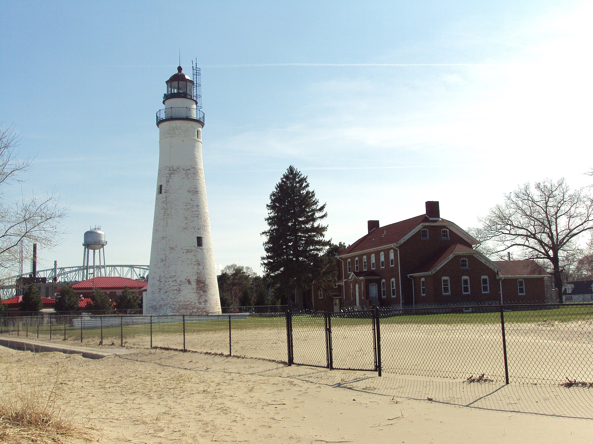
Port Huron and the Southern Start
Port Huron anchors the southern end where Lake Huron narrows into the St. Clair River, and it is the natural starting point for a northbound run. The city has a busy working waterfront with riverwalks, and the Fort Gratiot Lighthouse — among the oldest on the Great Lakes — sits at the point where the lake becomes the river. Freighter traffic passes close to shore here in a way that makes shipwatching effortless rather than a matter of luck.
Heading north, the highway settles into the pattern it will hold for the next hundred miles: water on the right, farmland on the left, and a small town every fifteen or twenty minutes. Lexington and Port Sanilac come first, both modest harbor communities with marinas and beaches, and both notably quieter than any comparable town on Michigan's western shoreline. This southern stretch is the least dramatic scenery on the route and the easiest driving, which makes it a good warm-up rather than a section to rush.
The Lake Huron Shore
North of Port Sanilac the shoreline grows more interesting. Harbor Beach is the significant stop — a city built around what is described as the largest man-made freshwater harbor in the world, its 1880s breakwater enclosing a harbor of refuge on a coast that offered vessels nowhere else to shelter. The 1885 sparkplug lighthouse marking the harbor entrance stands at the end of the north breakwall, and the Frank Murphy birthplace museum preserves the boyhood home of a man who became a U.S. Supreme Court Justice.
Port Hope follows, and then the road bends west around the tip. This eastern stretch is where the Thumb feels most exposed — the shore is rockier, the wind comes off open water with nothing to break it, and the roadside parks between towns are frequently empty even in July. Travelers looking for Lake Huron at its least developed will find it along here.
Around the Tip: Port Austin and Grindstone City
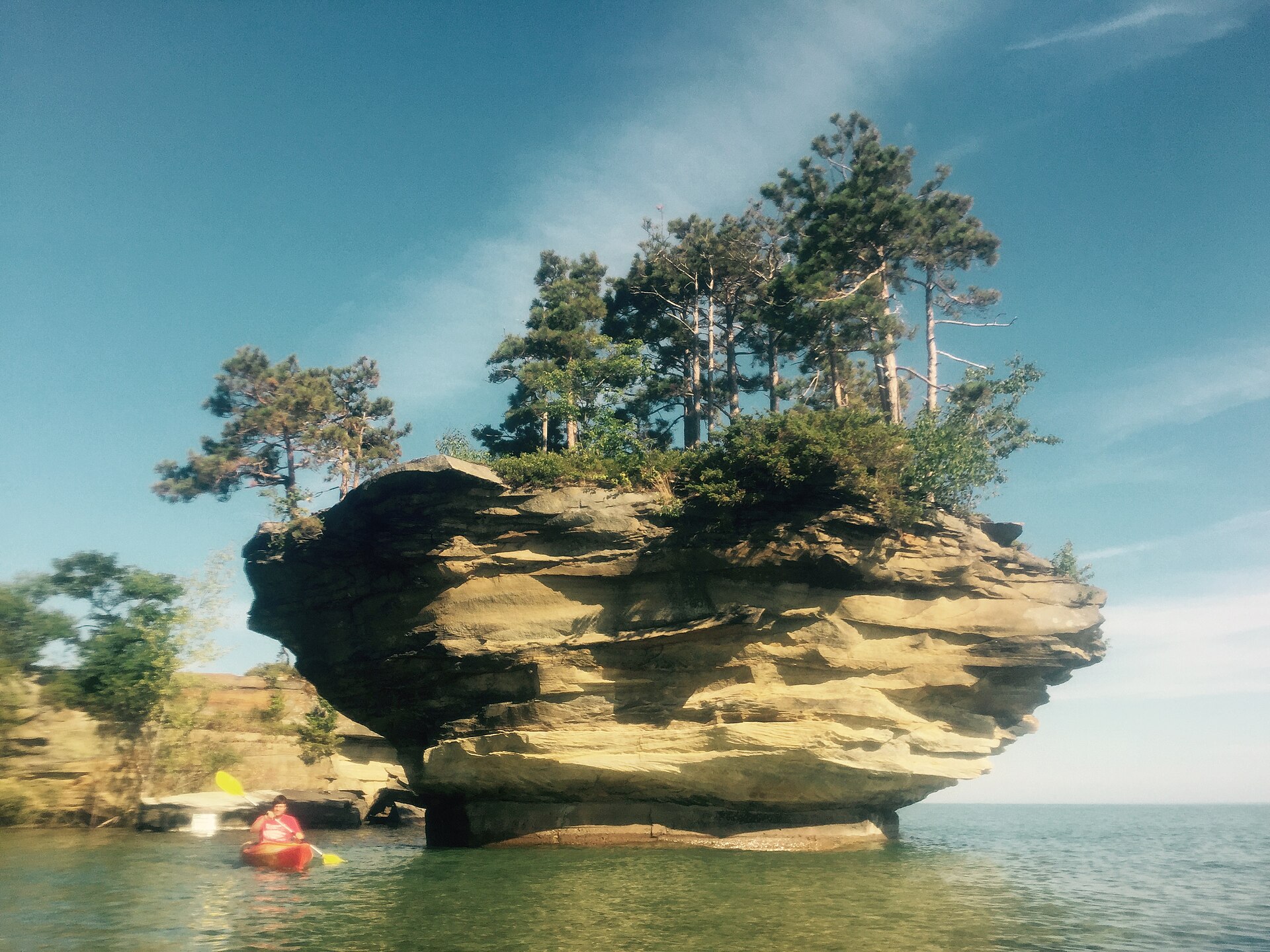
Port Austin sits at the very tip of the Thumb and is the route's headline destination. Just offshore stands Turnip Rock, a limestone pillar eroded into a top-heavy shape counted among the Seven Natural Wonders of Michigan — and reachable only by water, since the surrounding shoreline is private. Seeing it means a seven-mile round-trip paddle along the Point aux Barques shore or a boat tour, which is precisely why it has stayed uncrowded.
A few miles east, Grindstone City earned its name honestly: the local sandstone made exceptional grinding wheels, and the community shipped them until synthetic abrasives killed the market, leaving discarded grindstones lying along the shore where nobody thought it worth moving them. For paddlers, the sheltered marina at Grindstone City County Park is an alternative launch. This corner of the route deserves at least a full day rather than a drive-through.
The Saginaw Bay Side
Rounding the tip changes the trip completely. The Saginaw Bay shore is shallow, sandy, and considerably warmer than the open lake — the bay's geometry moderates temperatures in a way that makes swimming genuinely comfortable rather than an act of endurance. Caseville is the anchor community on this side, with Albert E. Sleeper State Park providing the public shoreline access and camping.
The driving here is flatter and the towns smaller, with long stretches of agricultural land running down to the water. It reads as gentler country than the eastern shore, and families with young children generally find this half the more usable of the two. The final run into Bay City brings the trip back to a real city, with the Saginaw River waterfront and the shipbuilding and lumber-baron history that built it.
Driving the Arc
The full 150 miles can be driven in a long half-day at highway pace, which misses the point entirely. Two days is the natural shape — a night in Port Austin or Caseville near the tip splits the route sensibly and puts a traveler in position for a morning paddle when the water is calmest. Three days allows the Turnip Rock trip, the Harbor Beach museums, and unhurried beach time without compressing anything.
Wind is the variable that matters most, more than temperature or even rain. Every marquee attraction on this route is on open water, and a forecast that reads as merely breezy inland can make the tip-of-the-Thumb paddle inadvisable. Checking a marine forecast rather than a general one, and keeping flexibility about which day the big paddle happens, is the single most useful piece of planning. Early mornings are reliably calmest, which conveniently aligns the safest conditions with the best light.
Why the Thumb Over the West Coast
The comparison every Michigan traveler makes is with the Lake Michigan shoreline, and the honest answer is that the Thumb offers less dramatic scenery for considerably less money and far fewer people. There are no dune systems here on the scale of Sleeping Bear, and no towns with the polish of Petoskey or Saugatuck. What there is instead is 150 miles of accessible shoreline where beach parking is rarely a problem, lodging can often be booked on short notice, and a summer Saturday does not feel like a queue.
Season runs shorter than on the west side. Summer is the clear window, with the Saginaw Bay water warm from July onward; autumn brings quiet and color inland without much shoreline drama; winter empties the coast almost entirely and produces genuinely spectacular ice formations along the eastern shore for travelers willing to dress for it. For a first visit, aim for late July or August and drive the arc counterclockwise from Port Huron, saving the warm bay water for the end.