In This Guide
The Trail Before the Highway Walker Tavern and Cambridge Junction The Irish Hills West Toward the Lake Driving the Heritage TrailBefore it was a highway it was a military road, and before that it was a footpath. US-12 across southern Michigan follows the route of the Old Sauk Trail, used by Native people through the 1700s and into the early 1800s, formalized as a military road in 1825, and then worn into the main stagecoach line between Detroit and Chicago — a journey that took five grueling days. Today the corridor is designated the US-12 Heritage Trail, and it runs some 210 miles across the bottom of the state from the Detroit area west to New Buffalo on Lake Michigan. What makes it worth driving is not scenery in the northern-Michigan sense but density of history: taverns that served stagecoach passengers, Depression-era roadside attractions, and small towns strung along a line that has carried traffic continuously for three centuries.
The Trail Before the Highway
The Sauk Trail was a functioning long-distance route long before Michigan was a state, worn across the southern part of the peninsula by generations of Native travelers moving between the Detroit River and Lake Michigan. When the federal government laid out a military road along essentially the same alignment in 1825, it was not so much building a new route as formalizing an old one — a pattern repeated across the eastern United States, where a surprising share of modern highways trace paths chosen by people on foot centuries earlier. The road became the principal stagecoach connection between Detroit and Chicago, and the five-day trip it required is the single fact that best explains everything else along it.
Five days meant travelers needed to stop, eat, and sleep at regular intervals, which produced a chain of taverns and inns spaced roughly a day's travel apart. Those buildings are the backbone of the heritage trail today. Understanding the corridor as infrastructure for a slow journey — rather than as a scenic drive that happens to have old buildings on it — reframes the whole route, and it explains why the interesting things cluster where they do rather than being distributed evenly.
Walker Tavern and Cambridge Junction
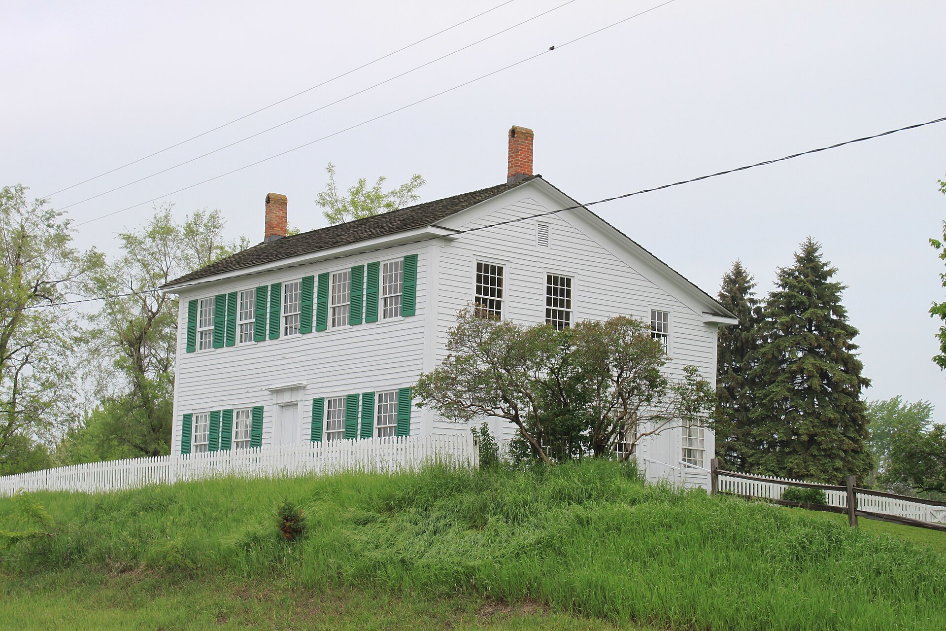
The finest surviving example sits at the intersection of US-12 and M-50, where the white clapboard Walker Tavern stands on a small bluff overlooking the highway. Built around 1832, it was originally only a few steps off the Old Sauk trail itself, and it became exactly what the traffic demanded: a place where travelers on the Detroit–Chicago run could rest, eat a meal, or take a bed for the night. The building survives as a museum whose exhibits concentrate on Michigan life in the first half of the nineteenth century — the frontier and stagecoach era — with an 1840s parlor, bar room, dining room, and kitchen furnished to period.
The same intersection holds Cambridge Junction Historic State Park and the Hewitt House Visitors Center, and together they make this the single most rewarding stop on the entire route. The Hewitt House is a 1929 colonial revival building, and its interpretive focus is a full century later than the tavern's: it tells the story of early automobile tourism, when the same corridor that once carried stagecoaches began carrying Model Ts full of families looking for somewhere to stop. The junction is commonly described as the gateway to the Irish Hills, and it functions that way in practice — the character of the drive changes noticeably on the far side.
The Irish Hills
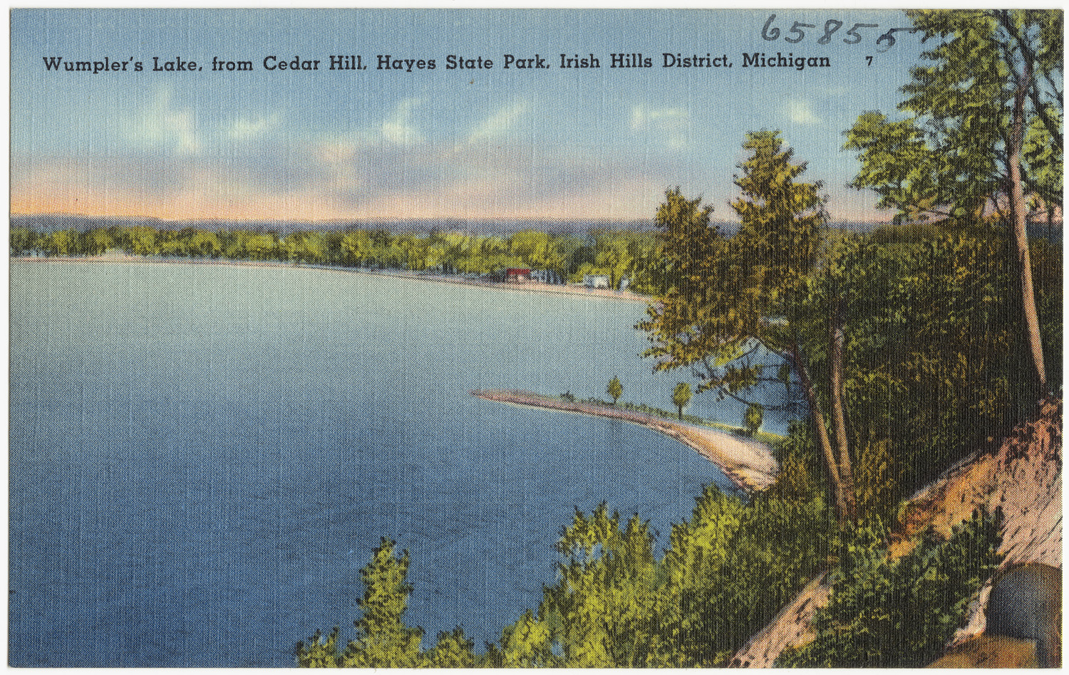
The Irish Hills occupy roughly southeastern Jackson County and northwestern Lenawee County, a stretch of glacially rumpled terrain dotted with small lakes that settled Irish immigrants took up between 1830 and 1850 and gave the region its name. The topography is the immediate appeal — after miles of flat southern-Michigan farmland the road begins to roll, and the combination of hills and water made this a natural place for nineteenth-century travelers to break a journey and, later, for twentieth-century motorists to spend a weekend.
That automotive era left the Irish Hills with its strangest and most beloved inheritance: a cluster of roadside tourist attractions built to catch the eye of families driving past at thirty-five miles an hour. Prehistoric Forest, Frontier City, and Mystery Hill were among the best known, and the Hewitt House interpretation treats them as a serious subject rather than a joke — they represent a specific and now largely vanished form of American vacationing, one that depended on a two-lane highway carrying all the traffic. The interstate system eventually routed that traffic elsewhere, and the fate of these attractions is a large part of why the corridor feels the way it does today.
West Toward the Lake
West of the Irish Hills the route continues through the tier of southern-Michigan county seats and small cities that grew up along it — Coldwater, with its restored opera house; Sturgis, where US-12 crosses M-66 and a traveler can pick up that highway north through the middle of the state; Three Rivers, at the confluence that named it; and Niles, close enough to the Indiana line that the road's Chicago destination starts to feel real. Each of these towns owes its position to the trail, and their downtowns retain the nineteenth-century commercial architecture that a through route paid for.
The corridor finishes at New Buffalo on Lake Michigan, where the trail that began at the Detroit River reaches the water it was always aimed at. New Buffalo functions today as a beach town serving Chicago rather than Detroit, which is a fitting inversion — the road's western end has been absorbed by the city at the far end of the original stagecoach run. Travelers finishing here have covered the width of the state on a single road, and the contrast between the Lake Michigan shoreline and the farm country three hours east makes the distance feel earned.
Driving the Heritage Trail
Unlike Michigan's northern scenic routes, US-12 is drivable comfortably in any season and demands no particular weather luck — the appeal is historical rather than scenic, and a gray November day suits a stagecoach tavern about as well as a June afternoon does. The full run takes a long day at highway pace, but two days allows for the museums to be visited properly rather than photographed from the parking lot, and the Irish Hills cluster alone can absorb most of an afternoon.
The practical advantage of this route over Michigan's more remote drives is that it never strays far from services. I-94 parallels the corridor for much of its length, which means fuel, food, and lodging are always within a short detour, and a traveler can bail onto the interstate at any point to make time. That accessibility is also the reason the trail survives in the condition it does: the towns along it never emptied out entirely, and the buildings stayed in use. For a first Michigan road trip, or for a trip taken outside the northern summer season, US-12 is the most reliably rewarding option in the state.