In This Guide
The Route Empire and the Dunes Traverse City Kalkaska and the Jack Pine Grayling and the Warbler Mio and the Au Sable Harrisville How to Drive ItM-72 runs 156.552 miles from M-22 in Empire, at the edge of Sleeping Bear Dunes, to US-23 in Harrisville on Lake Huron. It is the cleanest coast-to-coast line across the northern Lower Peninsula, and it changes character about four times on the way: dunes, then wine country and a city, then jack pine plains, then the Au Sable River, then a quiet Lake Huron town that most people have never heard of.
The Route
M-72 was designated by July 1, 1919, initially in a limited configuration on the eastern end. Today it runs the full width of the state at that latitude, from Empire on Lake Michigan through Traverse City, Kalkaska, Grayling, and Mio to Harrisville on Lake Huron.
Traffic tells the story of the road better than a map does: something over 32,000 vehicles a day near Traverse City, and roughly 800 a day at the eastern end. The same highway is a city arterial and an empty forest two-lane depending on where you stand on it.
Segments near Traverse City that run concurrent with M-22 and US-31 are part of the Lake Michigan Circle Tour, and the stretch between Traverse City and Grayling is on the National Highway System.
Empire and the Dunes
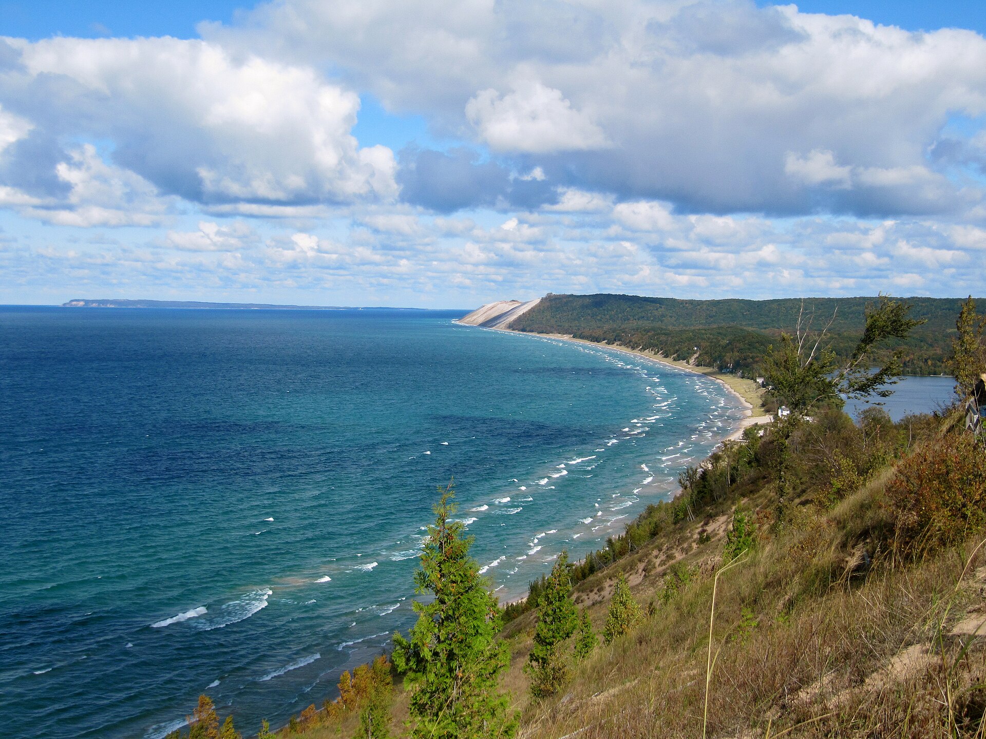
The western end could not be better placed. Empire sits at the southern end of Sleeping Bear Dunes National Lakeshore, and the park visitor center is in town. The Empire Bluff Trail is the short hike with the enormous payoff; the Dune Climb and Pierce Stocking Scenic Drive are both a few minutes north on M-109.
Start here rather than finish here if you can. Everything east of Empire is quieter, and the drive works better as a decompression than as a build-up.
M-72 leaves Empire heading east across the base of the Leelanau Peninsula toward Traverse City, which is about a half hour.
Traverse City
M-72 runs straight into the busiest tourist town in northern Michigan, and for about fifteen miles you are on a commercial strip rather than a scenic route. That is worth knowing in advance so it does not feel like a mistake.
It also puts you at the base of both wine peninsulas. M-37 up Old Mission and M-22 up Leelanau both leave from here, and between them they hold the great majority of northern Michigan's tasting rooms. If wine is any part of the trip, this is the day to stop driving east.
East of town M-72 climbs away from the bay and the traffic falls off quickly. By Kalkaska you are in a different kind of country.
Kalkaska and the Jack Pine
Kalkaska is where M-72 meets M-66 and US-131, making it the busiest crossroads on the eastern two-thirds of the route. The town is best known for the National Trout Festival and for sitting in the middle of some of the best brook trout water in the state.
East of Kalkaska the soil turns to sand and the forest turns to jack pine. This is not scenic in the postcard sense and it is one of the most ecologically distinctive landscapes in the Midwest: a fire-dependent system that exists nowhere else at this scale.
It is also the heart of the Kirtland's warbler's breeding range, which is the reason for the next stop.
Grayling and the Warbler
Grayling sits on the Au Sable River and is the center of the Kirtland's warbler story. The bird was on the federal endangered species list from 1967 until it was delisted in 2019, and its recovery is one of the genuine conservation successes in North America.
The Kirtland's Warbler Wildlife Management Area was established in 1980 and now covers 6,684 acres across 125 separate tracts in eight counties. Michigan Audubon runs guided tours in partnership with Hartwick Pines State Park across a window that runs from late May into the end of June; groups meet at the Hartwick Pines visitor center outside Grayling, get an orientation, and then caravan out to the protected pine barrens. Tours are capped at a small number of participants and a Recreation Passport is required to enter the park, so register well ahead. This is the only reliable way to see the bird, since the nesting areas are otherwise closed.
Grayling is also the start of the Au Sable River Canoe Marathon, run since 1947, which covers 120 miles overnight to Oscoda. Camp Grayling, the National Guard training facility, is just south of town, which is why you may share the road with military vehicles.
Mio and the Au Sable
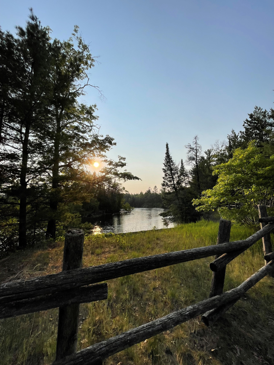
M-72 crosses the Au Sable twice: the South Branch near Luzerne and the main channel at Mio. Both crossings are worth pulling over for, and the Mio bridge is the better of the two.
This is fly-fishing country of real reputation. The Holy Waters stretch above Mio is catch-and-release trout water that anglers travel across the country to fish, and the town is small enough that a fly shop is a legitimate cultural institution.
Mio is also the eastern edge of the warbler country. From here to Harrisville the jack pine gives way gradually to hardwood and the road empties out almost completely.
Harrisville
The eastern terminus is US-23 in Harrisville, a small Lake Huron town with a harbor, a state park on the shoreline, and none of the pressure of the Lake Michigan side.
Harrisville State Park has a beach and a campground right at the edge of town, which makes it one of the easier state parks in Michigan to use without planning. The Sturgeon Point Lighthouse is a few miles north.
From here US-23 runs north as the Sunrise Coast toward Alpena and Mackinaw City, or south toward Oscoda, the mouth of the Au Sable, and the River Road National Scenic Byway, which follows the same river you crossed twice inland.
How to Drive It
Two days is right, three if you are fishing or stopping for wine. Straight through it is about three and a half hours, and there is no reason to do that.
West to east is the better direction for a first drive: you get the dunes while you are fresh, absorb Traverse City in the middle, and end somewhere quiet. East to west works if you are heading for the Sleeping Bear region and want it as the destination.
The single most important timing note is the warbler tour. If seeing a Kirtland's warbler matters to you, the window is mid-May to early July and nothing else will do. Book with Michigan Audubon before you set the rest of the trip.
Fall color on the eastern half is excellent and largely uncrowded, because everyone drives M-22 instead.