In This Guide
A Road Invented to Replace an Industry M-11 to the Dixie Highway to US-31 The Southern Beach Towns Muskegon to Ludington North Through the Dune Country Driving It TodayMost historic highways were built to move freight and only later acquired romance. The West Michigan Pike was different: it was built, deliberately and from the outset, to bring tourists. When logging collapsed along Michigan's western shore around the turn of the twentieth century, the towns left behind needed a new economy, and the answer they settled on was Chicago — specifically, Chicagoans with automobiles looking to escape the summer heat. The West Michigan Lakeshore Highway Association formed in 1911 to build the first improved highway up the Lake Michigan shore, construction ran through 1922, and the result was one of the nation's earliest purpose-built tourist roads. Today the corridor is a Pure Michigan Byway, and the resort towns it created are still living off the traffic it brought.
A Road Invented to Replace an Industry
The economic logic behind the Pike is unusually explicit for a highway. Michigan's western shoreline had been stripped of its white pine within a few decades, and the sawmill towns that lined the coast faced the standard extractive-industry reckoning: the resource was gone and the reason for the town went with it. What those towns had left was sand, water, and proximity to a very large city across the lake with a genuinely miserable summer climate.
The West Michigan Lakeshore Highway Association was founded in 1911 to act on exactly that observation, promoting construction of the first improved highway along Lake Michigan specifically to bring auto tourists from Chicago north into Michigan and support the resort industry rising from the logging economy's ashes. The road was built between 1911 and 1922, running along the lake's eastern coast from Michigan City at the Indiana line north toward Mackinaw City. It worked. The beach-town economy of western Michigan is, in a real sense, a deliberate invention.
M-11 to the Dixie Highway to US-31
The Pike's administrative history tracks the birth of American road numbering itself. In 1917 it was designated one of Michigan's first state trunk lines as M-11. In 1923 it was absorbed into the Dixie Highway, the named-highway network running from the Midwest to Florida in the era before numbered routes. Then in 1926, when the federal government established the first national highway system, the corridor became US-31 — the designation it still carries.
That sequence is why the Pike can be difficult to follow precisely today. Modern US-31 has been straightened, widened, and in places routed inland for speed, while the original Pike alignment often stayed closer to the water through the town centers it was built to serve. Travelers wanting the historic experience should expect to leave the modern highway repeatedly for business routes and old shoreline roads. The corridor was designated a Pure Michigan Byway in 2016, and the marked byway runs roughly 184 miles.
The Southern Beach Towns
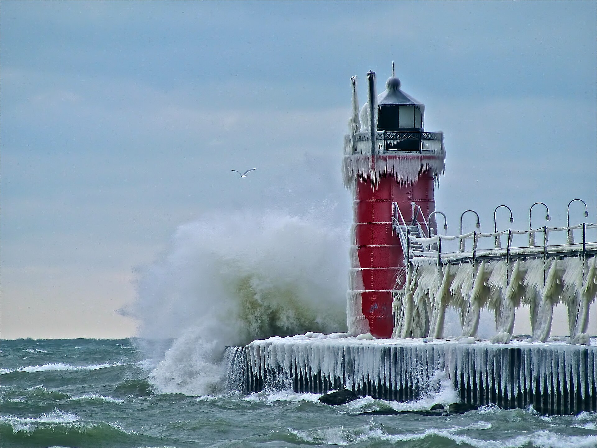
The southern end delivers the Pike's original purpose most directly, because these are the towns closest to Chicago and the ones the road was most explicitly built to serve. New Buffalo sits near the Indiana line and still functions largely as a Chicago beach town rather than a Michigan one. North of it, St. Joseph and South Haven carry the classic formula — a harbor, a pier, a lighthouse, a beach, and a walkable downtown built to separate visitors from their money in the most agreeable way possible.
Saugatuck and Douglas follow as the Art Coast, with galleries, the last hand-cranked chain ferry in the United States, and Oval Beach. Then Holland, with its Dutch heritage and Big Red lighthouse, and Grand Haven with its state park and musical fountain. This stretch is the densest concentration of resort towns on the route and the busiest in summer, which is precisely the outcome the 1911 association was hoping for.
Muskegon to Ludington
Muskegon marks a shift. It was the largest of the lumber ports and has the industrial bones to prove it, with a deep natural harbor, twenty-six miles of beach, three state parks, and attractions — the USS Silversides submarine, Michigan's Adventure — that are larger in scale and less boutique than the towns to the south. It is the point where the Pike stops being purely a resort corridor.
North of it, Whitehall and Montague sit on White Lake, Pentwater offers one of the more picturesque small harbors on the coast, and Ludington anchors the stretch with a five-thousand-acre state park between Lake Michigan and Hamlin Lake, the Big Sable Point Lighthouse at the end of a 1.8-mile sand path, and the SS Badger — the last coal-fired steamship operating in the United States, still crossing to Wisconsin twice a day. Manistee follows with its preserved Victorian downtown.
North Through the Dune Country
Above Manistee the character changes again as the route enters the dune country. Frankfort and Elberta face each other across a harbor, Sleeping Bear Dunes National Lakeshore rises beyond, and the Leelanau Peninsula and Traverse City wine country open to the north — the most heavily visited landscape on the entire corridor, and the stretch where the original Pike's promise of scenery is most fully delivered.
The northern reaches carry on through Charlevoix with its Earl Young mushroom houses, Petoskey on Little Traverse Bay, and Harbor Springs, before the corridor finishes at the Straits and Mackinaw City. A traveler who has driven from the Indiana line to the bridge has covered the entire western shore of the Lower Peninsula and passed through essentially every resort economy the Pike helped create.
Driving It Today
The Pike is best treated as a theme rather than a strict route. Following modern US-31 end to end is fast and misses the point; following the original alignment exactly requires research and frequent detours onto business loops and old lakeshore roads. The productive middle path is to drive the modern highway between towns and deliberately exit into every town center, which is where the Pike's actual legacy — the downtowns, the piers, the resort architecture — survives.
Allow a week for the full corridor and understand that any single segment can absorb several days on its own. Summer is the season the road was built for and brings both the full experience and the full crowds; September delivers warm lake water with the traffic gone and is arguably the better choice. For travelers who want the history rather than only the beaches, the Michigan State Historic Preservation Office has published research documenting the Pike's development, which turns a pleasant shoreline drive into something considerably more interesting.