In This Guide
The Route in One Paragraph The Gogebic End Marquette and the Middle Munising and Pictured Rocks The Seney Stretch Seney National Wildlife Refuge Newberry, Tahquamenon, and the East End How to Drive ItUS-2 gets the postcards because it runs along the water. M-28 gets the Upper Peninsula. It is the longest state trunkline in Michigan carrying an M- prefix, 290.373 miles from Wakefield in the far west to a junction with M-129 outside Sault Ste. Marie, and it crosses nearly the entire peninsula through iron country, Lake Superior shoreline, a national wildlife refuge, and a twenty-five-mile straightaway across a swamp that could not be drained. If you drive one road in the U.P., this is the one that shows you what the place actually is.
The Route in One Paragraph
M-28 was designated around July 1, 1919. It begins at US-2 in Wakefield, in the Gogebic Range near the Wisconsin line, and ends at M-129 in Bruce Township, Chippewa County, just short of Sault Ste. Marie. Between those points it passes through Bruce Crossing, Baraga, Marquette, Munising, Seney, Newberry, and Raco.
Two sections carry memorial names. From the western terminus to the Ishpeming-Negaunee city line it is the Veterans Memorial Highway; from there east to the M-123 junction in Chippewa County it is the D.J. Jacobetti Memorial Highway.
Three separate stretches are also part of the Lake Superior Circle Tour, which is the practical reason M-28 exists in a traveler's itinerary at all: for long portions of the U.P., it is simply the road.
The Gogebic End
Wakefield and Bessemer sit in the old Gogebic Iron Range, and the western twenty miles of M-28 are a mining landscape that has been growing back into forest for a century. This is also where you are closest to the Porcupine Mountains and to the Black River Byway, which drops north to Lake Superior through five waterfalls.
If you are starting here, do not start early. Give the west end a full day of its own before you begin driving east, because the density of things worth stopping for in Gogebic and Ontonagon counties is higher than anywhere else on the route.
From Wakefield, M-28 runs northeast through Bruce Crossing, where it meets US-45, and on toward Baraga and the head of Keweenaw Bay.
Marquette and the Middle
Marquette is the largest city in the Upper Peninsula and the natural midpoint of this drive. M-28 delivers you into it along Lake Superior, and the approach from the west, with the lake opening up on your left, is one of the better arrivals in Michigan.
Everything Marquette offers is within a few minutes of the highway: Presque Isle Park on its 323 acres with the Black Rocks, Sugarloaf Mountain and its 1.2-mile loop climbing 470 feet above Lake Superior, the 1932 Lower Harbor ore dock at 969 feet long and roughly 75 feet above the water, and the Iron Ore Heritage Trail running 47 miles from Republic to Chocolay Township.
West of Marquette, Ishpeming and Negaunee are the iron towns that built it. The Michigan Iron Industry Museum sits near Negaunee on the site of one of the first iron forges in the Lake Superior region.
Munising and Pictured Rocks
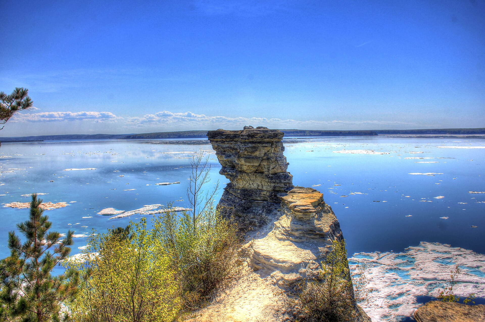
Munising is the single biggest reason a first-time visitor drives M-28. Pictured Rocks National Lakeshore begins here, and the boat tours out of the city harbor are the only practical way for most people to see the cliffs from the water, which is the way they are meant to be seen.
The waterfalls around Munising are unusually accessible for the U.P. Munising Falls, Wagner Falls, and Alger Falls are all short walks from parking, and Miners Falls and Miners Castle are a short drive up the lakeshore.
Au Train, just west of Munising, has a beach on Lake Superior that most people drive straight past. It is worth the twenty minutes.
The Seney Stretch
East of Shingleton, M-28 does something no other Michigan highway does. For twenty-five miles it runs perfectly straight and nearly perfectly level across the Great Manistique Swamp to Seney. It is the longest such section of highway in the state and is described as one of the longest curveless stretches east of the Mississippi.
The reason is geological rather than engineering vanity. The swamp is spring-fed and resisted every attempt to drain it for farmland, so when the road went through in the 1920s there was nothing to contour around: no hills, no farms, no property lines. The surveyors pointed it at Seney and built.
Drivers either love it or find it unnerving. There is no scenery in the conventional sense, no traffic, and no reference point, and the effect after fifteen minutes is genuinely strange. Fill the tank before you start. There is nothing between the two ends.
Seney National Wildlife Refuge
At the eastern end of the stretch, Seney National Wildlife Refuge protects 95,212 acres of wetland and upland, roughly sixty-five percent of it wetland. It is one of the great birding properties in the Great Lakes and almost nobody stops.
The Marshland Wildlife Drive is a seven-mile auto route through the pools, which means you can see a serious amount of it without leaving the car. The Pine Ridge Nature Trail is the short walk. Trumpeter swans, loons, sandhill cranes, and bald eagles are the birds people come for.
This is the correct antidote to the Seney Stretch. Twenty-five miles of nothing, then ninety-five thousand acres of something.
Newberry, Tahquamenon, and the East End
Newberry is the junction with M-123, which is the turnoff for Tahquamenon Falls and the Whitefish Bay country. If you have not seen the Upper Falls, take it; the M-123 loop rejoins M-28 further east and costs you a day rather than a detour.
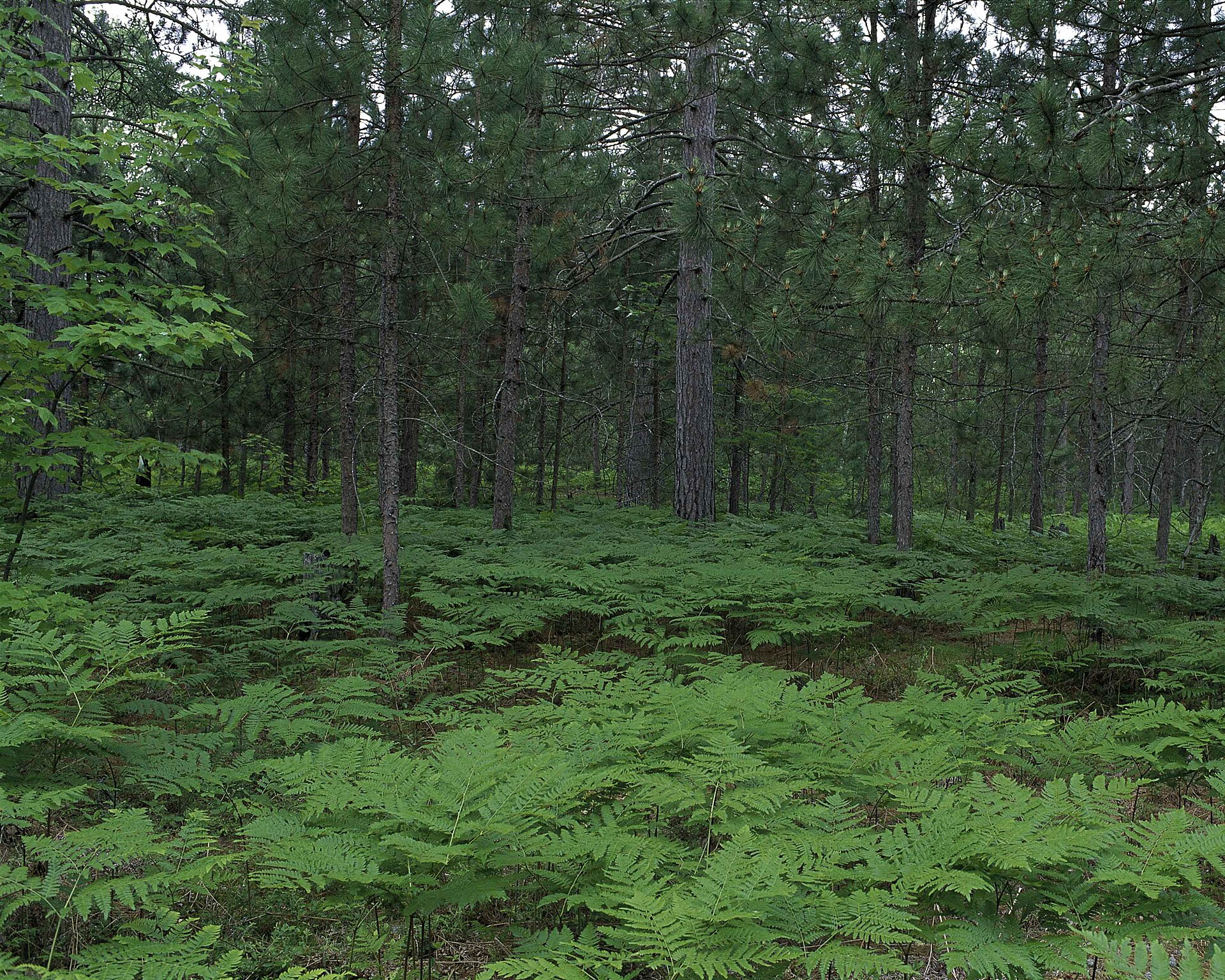
Staying on M-28, the road runs through Raco and the Hiawatha National Forest toward Brimley, where the Whitefish Bay Byway heads north along the shoreline. This eastern third is the emptiest driving on the route after the Seney Stretch itself.
M-28 ends at M-129 in Bruce Township. Sault Ste. Marie, the Soo Locks, and the international bridge are a few minutes further on.
How to Drive It
Three days minimum, four is better, and that assumes you are not also doing Pictured Rocks and Tahquamenon properly. Driven straight through with no stops it is roughly six hours, which is a number worth knowing and not worth using.
Go west to east if you want the drive to build, because Marquette and Munising are stronger than the east end and you will want them in the middle rather than at the finish. Go east to west if you are heading for the Porcupine Mountains and want to end there.
Fuel discipline matters here more than on any other Michigan route except US-2 west of Naubinway. Gas stations are far apart, some close early, and cell coverage is unreliable across the middle. Fill up in Munising before the Seney Stretch and in Newberry before the run to the Soo.
Summer and early fall are the seasons. M-28 is plowed and open in winter, but it runs through some of the snowiest country in the eastern United States, and the middle of it is not where you want to be learning that.