In This Guide
St. Ignace to Naubinway: The Beach Run Manistique and the Central Stretch The Iron Country Watersmeet to Ironwood Driving the Full LengthUS-2 is the Upper Peninsula's spine. It runs roughly 305 miles from St. Ignace at the foot of the Mackinac Bridge west to Ironwood on the Wisconsin border, and for a substantial share of that distance it is the only through route — there is no parallel highway, no interstate alternative, and no way to cross the peninsula east to west without using it. That monopoly makes it a working road rather than a purely scenic one, but it also means every U.P. traveler ends up on it eventually. What surprises first-timers is how good the driving actually is: the highway was built on the traces of an ancient Native trade route, and the eastern third in particular runs along tall bluffs before dropping down to skirt miles of nearly deserted Lake Michigan beach.
St. Ignace to Naubinway: The Beach Run
The eastern end begins at St. Ignace, where US-2 leaves I-75 within sight of the Mackinac Bridge, and the first fifty miles are the most photographed stretch of the entire route. The highway runs directly alongside Lake Michigan here, with white sand dunes rolling down into water that turns a startling turquoise on a bright day — a color most travelers associate with somewhere considerably further south. Roadside pullouts are frequent and largely unmarked, and the beaches they access are often empty even in July, which is close to inconceivable on the Lower Peninsula's western shore at the same latitude.
This is the section that rewards abandoning any schedule. The dunes are climbable, the water is swimmable in late summer, and the sequence of pullouts means a traveler can stop half a dozen times in an hour without ever walking more than a few minutes from the car. Naubinway marks the end of the run and is worth knowing for what it is: the largest commercial fishing port on the Great Lakes anywhere in the Upper Peninsula, a working harbor rather than a resort, and a useful reminder that this coastline still supports an industry.
Manistique and the Central Stretch
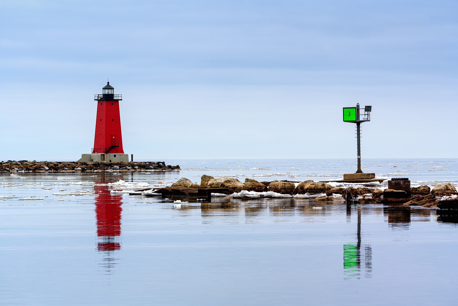
Manistique sits roughly eighty minutes west of St. Ignace on the Lake Michigan shoreline and functions as the eastern half's main service town. It is a genuine stop rather than a fuel-and-go — a walkable downtown, a boardwalk, and a lighthouse — and it also anchors the newer Pure Michigan Byway designation that runs from downtown St. Ignace west through Manistique to Thompson. Travelers who want the formally recognized scenic portion of US-2 are driving that segment whether they know it or not.
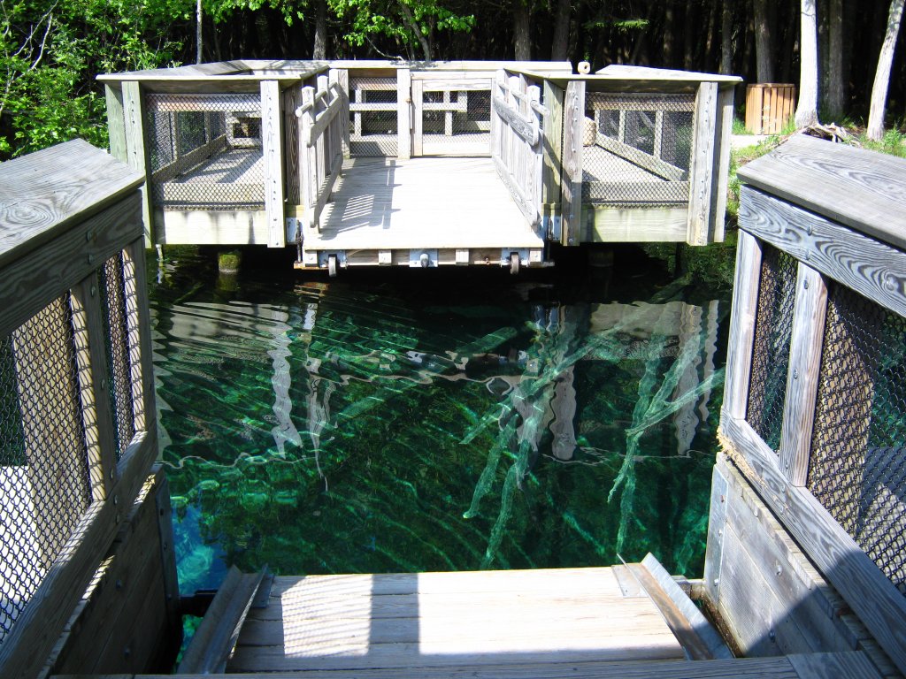
Just north of Manistique lies one of Michigan's most-visited natural attractions, Kitch-iti-kipi at Palms Book State Park — the state's largest freshwater spring, 200 feet across and 40 feet deep, with more than 10,000 gallons a minute rising through fissures in the underlying limestone at a constant 45 degrees year-round. A self-propelled observation raft carries visitors across it, and the water is clear enough to show ancient submerged tree trunks, lime-encrusted branches, and cruising trout on the bottom. It is a short detour off US-2 and close to mandatory on a first trip. West of Manistique the highway continues through Thompson and Rapid River toward Escanaba, and the character shifts inland — the Lake Michigan views become intermittent, the forest thickens, and the driving becomes more about distance than scenery.
The Iron Country
Escanaba is the largest city on the route and the practical midpoint for anyone driving the full length, offering full services and the last easy resupply before the western U.P. From there US-2 turns inland and northwest into the iron ranges, running through Iron Mountain and Iron River — towns whose names are plain descriptions of why they exist. This is mining country of a different vintage and geology than the copper country to the north, and the industrial history is legible in the towns themselves rather than confined to museums.
The stretch between Escanaba and the Wisconsin border is the longest and emptiest driving of the trip, and travelers should treat fuel and daylight seriously here. Cell coverage is patchy, services cluster in the towns rather than spreading along the highway, and winter conditions on this segment are genuinely serious — this is snow country in a way the Lake Michigan shore is not. The compensation is a landscape of hardwood forest and small lakes that goes on for hours with almost no development.
Watersmeet to Ironwood
The far western leg passes through Watersmeet, which is worth building a stop or a night around: the Sylvania Wilderness lies a few miles west with its old-growth forest and undeveloped lakes, and the Paulding Light appears down a dead-end gravel road a few miles north of town on most evenings. A traveler running US-2 end to end who does not detour for at least one of those two is missing the most distinctive thing on the western half of the highway.
Wakefield and Bessemer follow, and then US-2 reaches Ironwood at the Michigan–Wisconsin line — the western terminus, and the far corner of the state. This is the heart of the region known as Big Snow Country, a name earned from the lake-effect snowfall Lake Superior delivers here; the area averages on the order of 200 inches a season, and the winter of 1996–97 brought a recorded 298.1 inches to Ironwood. The town's identity is bound up in skiing to a degree that surprises summer visitors. Finishing here means a traveler has crossed the entire Upper Peninsula on one road, from the Mackinac Bridge to the Wisconsin border, and the sense of distance covered is considerable.
Driving the Full Length
US-2 can be driven end to end in a single long day, and plenty of people do it as transit rather than as a trip. Doing it properly takes two days minimum and three comfortably, with the natural overnight stops falling at Manistique or Escanaba depending on how much of the eastern beach run a traveler lingers over. Running west to east reverses the experience usefully — it saves the dunes and turquoise water for the finish rather than opening with them, which is the stronger sequence if a traveler is ending at the bridge anyway.
Season matters enormously. Summer delivers the swimmable water and the open businesses; late September brings hardwood color across the whole interior; winter turns the western half into a serious undertaking that should not be attempted casually, though it is maintained and driven year-round by people who live there. Whatever the season, the practical advice is the same and it is worth repeating: fuel in the towns rather than between them, because the gaps on this highway are longer than almost anywhere else in Michigan.