In This Guide
North Along Grand Traverse Bay Leland and Fishtown Sleeping Bear Dunes Benzie County to Manistee Timing and PracticalitiesNo Michigan highway has been merchandised harder than M-22. The route number appears on stickers, hats, and shop windows across the northwest Lower Peninsula, and the branding has become so thoroughly detached from the road that plenty of people wearing it have never driven the thing. That is a shame, because the road earns it. M-22 runs roughly 116 miles, tracing the Lake Michigan shoreline around the Leelanau Peninsula, forming part of the Lake Michigan Circle Tour and passing directly through Sleeping Bear Dunes National Lakeshore. It is a loop-shaped route around a peninsula rather than a line between two points, which means a driver ends up more or less where they started having seen water on both sides.
North Along Grand Traverse Bay
The natural starting point is Traverse City, and the first leg runs north along the western shore of Grand Traverse Bay with the water on the right for most of it. Suttons Bay comes first — a village with a walkable main street and a harbor — followed by Peshawbestown, the seat of the Grand Traverse Band of Ottawa and Chippewa Indians, and Omena, smaller still. The drive here is gentle rather than dramatic: orchards and vineyards on the inland side, bay on the other, and a succession of small settlements close enough together that stopping at all of them is entirely feasible in a morning.
Northport sits at the very tip of the peninsula, where Grand Traverse Bay and Lake Michigan converge, and it has the particular character of a place at the end of a road. The village is quiet, the marina small, and the restaurants better than the population would suggest — a common pattern in northern Michigan, where seasonal money supports kitchens that could not otherwise exist. Travelers doing the loop in a single day often treat Northport as the turning point and the natural lunch stop, which it handles well.
Leland and Fishtown
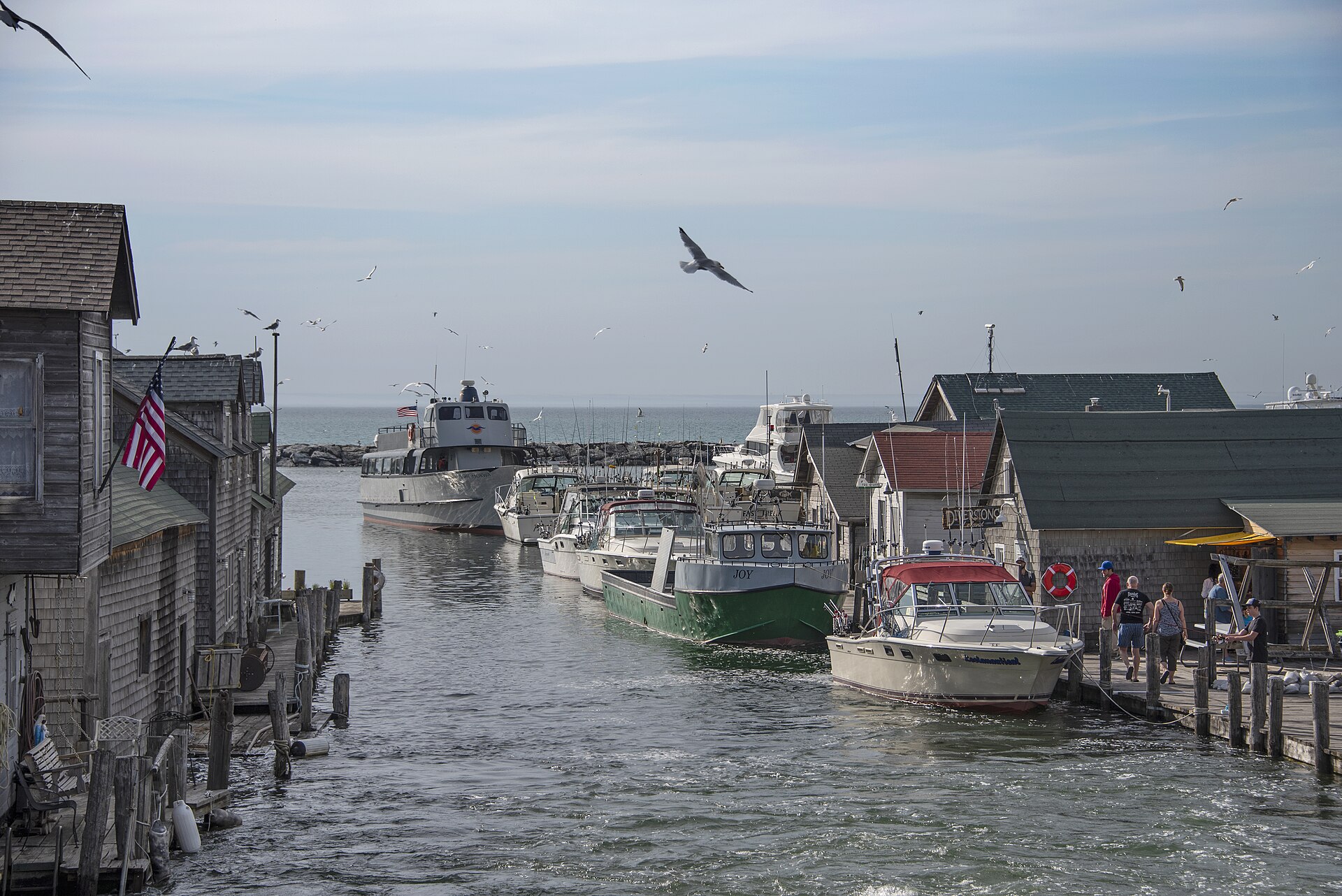
Coming south down the peninsula's Lake Michigan side, Leland delivers what may be the single most photographed scene on the route. Fishtown is a National Historic District preserving the weathered fishing shanties that stand on pilings over the Leland River, survivors of a commercial fishing industry that has largely disappeared from the Great Lakes. The buildings now house smoked fish shops, galleries, and small boutiques, and the obvious criticism — that a working waterfront has become a shopping district — misses that the alternative was demolition. The shanties survive because they found a second use.
Leland is also the mainland departure point for the Manitou Islands, which lie offshore within Sleeping Bear Dunes National Lakeshore and give the whole stretch of coast its distinctive layered horizon. Travelers with a spare day can make the crossing; travelers without one should at least understand what they are looking at from shore, because the islands are not scenery so much as the remnants of the same glacial event that built the dunes and the peninsula itself.
Sleeping Bear Dunes
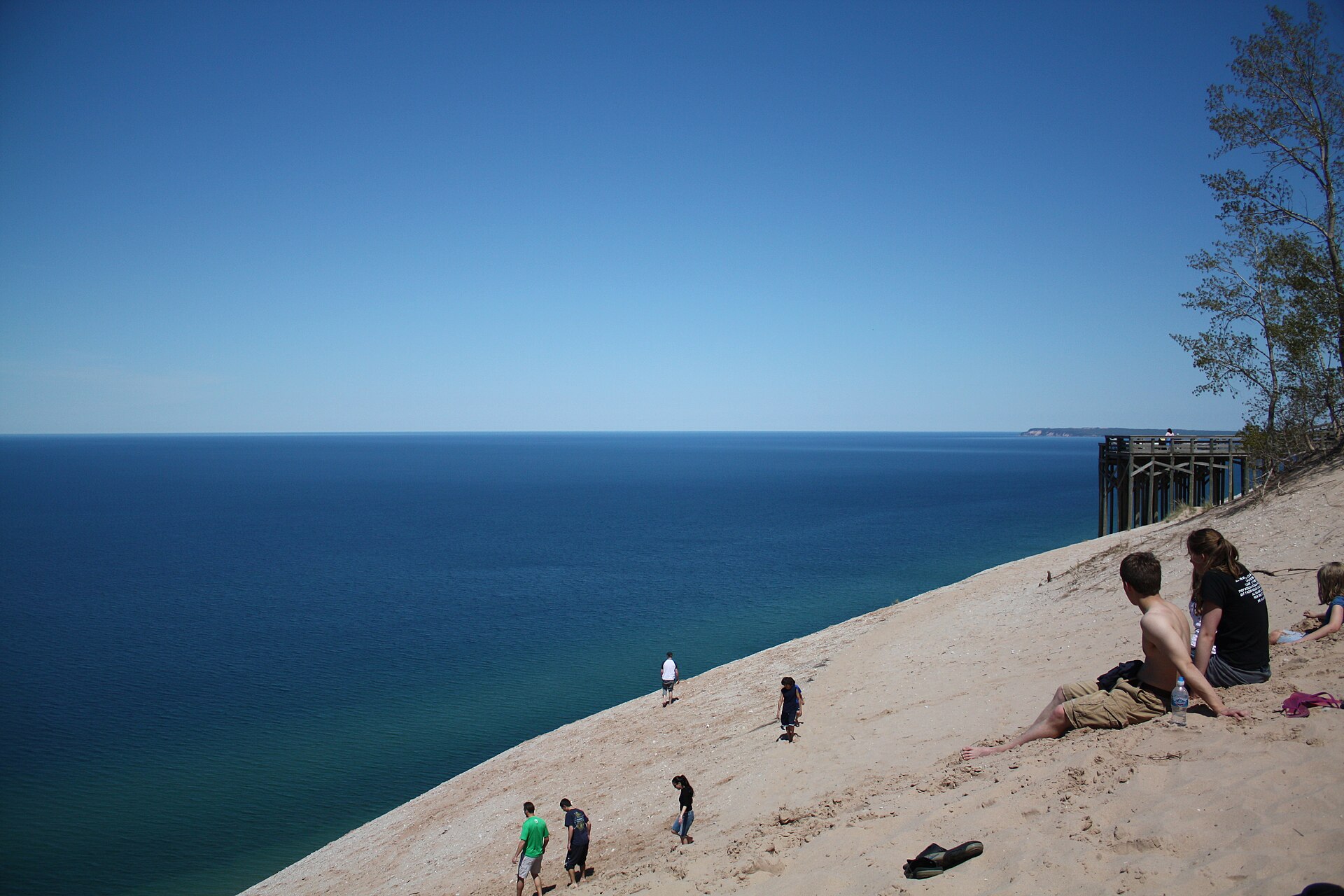
South of Leland the route enters Sleeping Bear Dunes National Lakeshore, and at Glen Arbor the byway turns off onto M-109 to run through the heart of it before rejoining M-22 at Empire. This detour is not optional in any meaningful sense — it is where the Pierce Stocking Scenic Drive and the most celebrated dune overlooks are, and skipping it to stay on the numbered route would be a peculiar act of literalism. The dunes here are perched hundreds of feet above Lake Michigan, and the view from the overlooks is the image that sells northern Michigan to the rest of the country.
Empire marks the southern end of the national lakeshore's most intense stretch and functions as its service town. From here M-22 continues south into Benzie County, and the character shifts again — less dramatic, less crowded, and considerably easier to enjoy at a normal pace. Travelers who have spent the morning fighting for parking at dune overlooks often find this the most pleasant driving of the day.
Benzie County to Manistee
Beulah sits at the eastern end of Crystal Lake, and Frankfort and Elberta face each other across the harbor where the Betsie River reaches Lake Michigan — Frankfort a former car-ferry town turned beach community, Elberta smaller and quieter on the opposite shore. This southern stretch of M-22 sees markedly fewer visitors than the Leelanau half, which makes it the portion most likely to feel like a discovery rather than a checklist item, and the beaches are correspondingly less contested.
The route ends at Manistee, a Victorian lumber town rebuilt on the water after its boom years, and finishing here rather than looping back to Traverse City makes for a more satisfying trip shape. A traveler who runs M-22 end to end has covered the shoreline from Grand Traverse Bay to Manistee, threaded a national lakeshore, and passed through perhaps a dozen towns that each merit a stop. Doing it in one day is possible and slightly absurd; two days is right, and three is better if the weather cooperates.
Timing and Practicalities
Season governs everything on this route. July and August bring the crowds the branding has earned, and the stretch between Glen Arbor and Empire in particular can be genuinely congested, with dune-area parking filling by mid-morning. Late September and early October deliver the fall color that makes the drive arguably better than it is in summer, with a fraction of the traffic — this is the connoisseur's window, and it is short. Winter empties the route almost entirely and rewards travelers who accept that many seasonal businesses will be closed.
A national lakeshore entrance pass is required for Sleeping Bear, and buying it in advance saves time at the booth. Beyond that the logistics are easy: this is a well-served tourist corridor with lodging, dining, and fuel throughout, and the only real planning constraint is booking ahead in peak season. Driving the loop counterclockwise — north along the bay, south down the Lake Michigan side — puts the water on the driver's side for the more scenic half and saves the dunes for the middle of the day, which is the sequence most worth recommending.